| Maps > United States > Maryland |
 |
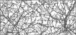
Map of Maryland, Map of Maryland. |
 |
Map of Maryland, 1600's Map of Maryland. |
 |
Swampy Divides in Maryland, A map showing the swampy divides in eastern Maryland between the Chesapeake and the Atlantic. The coastal plain is here so young and so little dissected that many of the original irregularities have not yet been destroyed. |
 |
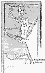
Maryland in 1652, 1652 A map of Maryland in 1652. |
 |
Maryland, 1814 A map showing Maryland, where the Battle of Bladensburg was fought. |
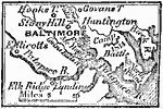 |
Vicinity of Baltimore, 1814 A map showing the vicinity of Baltimore in 1814. |
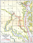 |
Chesapeake Campaign, 1814, 1814 Chesapeake Campaign in 1814 |
 |
Map of Memphis to Vicksburg, September 1862 Battle of Antietam, Maryland in the American Civil War. |
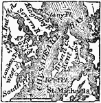 |
Vicinity of Annapolis, 1872 Annapolis (formerly called Providence), now the capital of Maryland, is situated on the S.W. side of the river Severa, two miles from its entrance into Chesapeake Bay. It is twenty five miles S. from Baltimore, and thirty-three N.E. from Washington D.C. |
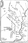 |
Battle of Antietam, 1881 A map showing the plan for the Battle of Antietam. |
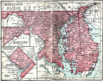 |
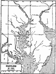
Maryland and Delaware, 1906 Map of Maryland and Delaware in 1906. |
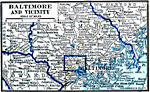 |
Baltimore and Vicinity, 1922 Baltimore and neighboring counties. |
| Maps > United States > Maryland |
Maps is a part of the Educational Technology Clearinghouse
Produced by the Florida Center for Instructional Technology © 2007
College of Education, University of South Florida