The Rivers and Streams ClipArt gallery offers 79 illustrations of watercourses varying in size from broad rivers to small streams. The illustrations include creeks, brooks, rivulets, tributaries, and rills.
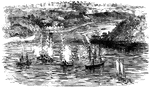
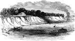
Acquia Creek
"The attack upon the batteries at the entrance of Acquia Creek, Potomac River, by the United States…

Amazon River
The Amazon River is the largest, most voluminous river on earth, having a greater total flow than the…
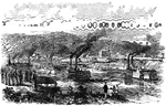
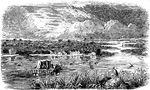
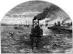
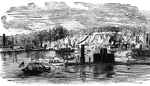
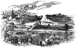
Bellaire, Ohio
"Bellaire, O.- Steamboats conveying troops and munitions of war for the Federal forces on the Great…
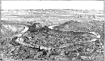

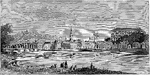
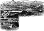
Chattanooga, Tennessee in 1862
Chattanooga, "the Scenic City", is the fourth-largest city in Tennessee (after Memphis, Nashville, and…


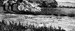
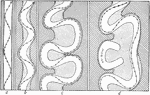
Current
Diagram showing the stronger meandering of the current as compared with the river as a whole.
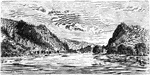
Confluence of the Tigris and Euphrates
"In their upper course the Euphrates and the Tigris traverse a region of steppes broken by rocky ridges…
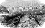
Federal Fleet
"Panoramic view of the Federal fleet passing the forts of the Mississippi, on its way to New Orleans,…
Fort Oswegatchie
In 1749, a Suplican priest, Abbé Picquet, built a mission fort named Fort de La Présentation, or Fort…
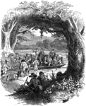
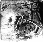
General Nathanael Greene Crossing the River Dan
Nathanael Greene was a major general of the Continental Army in the American Revolutionary War. Here…
Where Hamilton Fell
The duel was held on July 11, 1804, along the west bank of the Hudson River on a rocky ledge in Weehawken,…
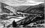
View of Harper's Ferry, 1862, Looking South
The town of Harper's Ferry, where an important Civil War battle was fought in 1862.
Hudson River
Profile of the Hudson River from New York City through the Highlands, showing the fjord-like excavation…
Hudson's Exploration
An illustration showing Henry Hudson's ship exploring the river which now bears his name.

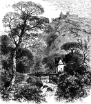
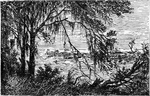
Ivy Bridge
Turner painted this picture displaying his incredible techniques with watercolors. It can now be found…

James River
"Scene on the James River, at Richmond. This view is from a long shaded island extending up the river…
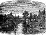
King's Bridge
"View at King's Bridge. This view is from the southwest side of the stream, from near the tide-mill.…
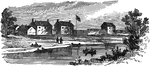
Kinzie Mansion and Fort Dearborn
Fort Dearborn, named in honor of Henry Dearborn, was a United States fort built on the Chicago River…
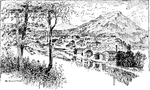
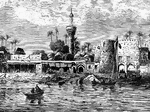
Lintz on the Dabube
A picturesque view of Lintz (Linz) on the Danube with a small number of buildings on the river banks.…
View of Lintz
A picturesque view of the Lintz (Linz) city center. Lintz was founded by the Romans, who called it "Lentia."…
Bridge over the Swift, Lutterworth
The town was granted its Market Charter in 1214 by King John and continues to hold a market to this…

River Meander
A meander river with oxbow lakes. An oxbow lake is a U-shaped lake formed when a wide meander of a river…
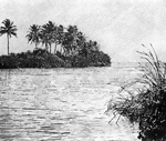
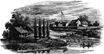
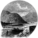
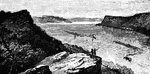
Miami River
"The mouth of th Miami River, Florida, whenever Florida started to be devloped in the 1890's."—E.…
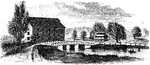
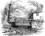
Mill on a Mountain Stream
A small mill sits on a briskly-flowing mountain stream. A footbridge crosses the stream. A larger building…
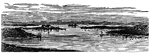
Scene of Mississippi
The Mississippi Valley lies between the predominant and secondary mountain-systems. It is over 300,000…

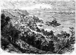
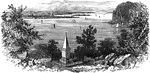
Natchez, Mississippi
An illustration of Natchez, Mississippi looking down from a hill. In the late 18th-century Natchez was…
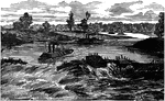
The Great Naval Battle on the Mississippi
First day's bombardment, Federal Schooners off Forts Jackson and St. Philip, commanding the passage…


Lafayette Park
An view of Lafayette Park in St. Louis, Missouri. A woman walking across a small wooden bridge over…
Fort Pawhatan
"The campaign on the James River- General Butler landing at Fort Pawhatan."— Frank Leslie, 1896
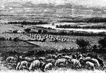
Recrossing the Potomac
"General Banks's Division recrossing the Potomac from Williamsport, Md., to attack the Confederate army…

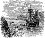
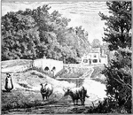
Prescott's Headquarters
"Prescott's Headquarters. This house is on the east side of the west road, about a mile from the bay.…
Recrossing the Rappahannock
"The war in Virginia. General Meade recrossing the Rappahannock, October, 1863, before Lee's advance.…
Red River Expedition
The Red River Campaign or Red River Expedition consisted of a series of battles fought along the Red…
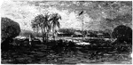
Boy Diving into a River at Sunset
A scene illustrating a young boy jumping off of a diving board into a river. In the distance there is…
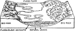
Flood Plain of a River
Block diagram showing the flood-plain of a river, with ox-bows and marginal streams and in section,…

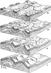
Development of River Systems
Diagrams showing the development of river systems in anticlinal folds with anticlinal valleys as the…
Miami River
An illustration of the mouth of the Miami River. The Miami River is a river in Florida that drains out…
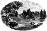
Savannah River
The Savannah River is a major river in the southeastern United States, forming most of the border between…