The Rivers and Streams ClipArt gallery offers 79 illustrations of watercourses varying in size from broad rivers to small streams. The illustrations include creeks, brooks, rivulets, tributaries, and rills.
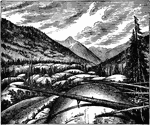
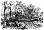
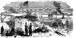
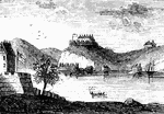
Landing Place of Troops on the Salmon River
General Wilkinson settled into winter quarters at French Mills on the Salmon River during the War of…

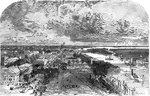
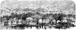
Savannah, Georgia, Looking East
"View of Savannah, Ga., looking east, toward Fort Jackson. Savannah, the entry port of Georgia, is built…
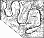
Meanders of the Seine
Intrenched meanders of the Seine in the old peneplane cut upon the strata of the Paris Basin; near Rouen.
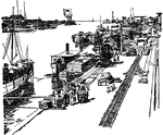
Pasig River
Shipping docks at Pasig River, Manila in the Philippines during the Spanish-American War.
Battle of Stone River
"Battle of Stone River, Tenn. The decisive charge of General Negley's division across the river- the…

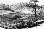
Susquehanna River
Making up rafts on the Susquehanna River. A scene on the line of the Erie Railroad.
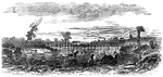
Fort Thompson
"View of New Berne, N. C., from the interior of Fort Thompson after its capture by the Federal forces-…
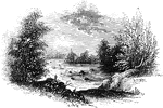
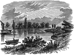
Tuckesege Ford
"View at Tuckesege Ford. This view is from the western bank of the Catawba, looking down the stream."—Lossing,…
War in Virginia
"The war in Virginia--railroad bridge over the Rappahannock, at Rappahannock Station."— Frank Leslie,…
West Point
"West Point in 1780. This view is from a print published in the New York Magazine for 1790.…
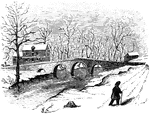
Worth's Mills
"Bridge at Worth's Mill's. This substantial stone bridge, over Stony Brook, is upon the site of the…