Glaciers
The Glaciers ClipArt gallery includes 27 illustrations of large bodies of ice that slowly flow due to their great weight.
Phenomena of Wells and Springs in Drift Material
Drift material, loose material left on the surface by a retiring glacier, plays a part in wells and…
Origin of Eskers
Diagrams showing the origins of eskers. A) A tunnel under the ice, nearly filled with sand and gravel…
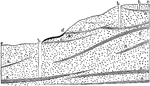
Frontal Apron Plain
Disgrams illustrating the mode of formation of the frontal apron-plain and its relation to the terminal…
Glacier
Glacier descending into the sea, where its front is buoyed up by the water and becomes broken up into…
Glacier
A glacier is a large, slow-moving mass of ice, formed from compacted layers of snow. Glacier ice is…
Glacier Contours
In cartography, a contour line (often just called a "contour") joins points of equal elevation (height)…
Glacier Form Lines
In cartography, a contour line (often just called a "contour") joins points of equal elevation (height)…
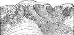
Glacier Mountain Range
Diagram of a mountain region from which the former glaciers have melted away, leaving the cirques to…
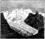
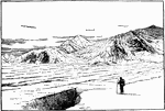
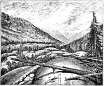
Seward Glacier
Surface of Seward Glacier, Alaska. The summit of Mt. St. Elias is seen in the distance beyond the hills…
Glaciers
Diagram to illustrate the relationship of main and tributary glaciers. The surfaces of the two glaciers…
Ice Tongues
Three of the largest ice tongues of the Swiss Alps superposed on the same scale over Hubbard Glacier,…
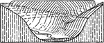
Formation of Kettle Holes
Diagrams to illustrate the mode of formation of kettle holes in glacial deposits.
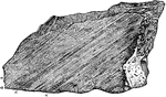
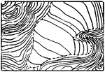
Limestone
Limestone polished, furrowed, and scratched by the modern glacier of Rosenlaui, Switzerland.
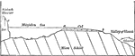
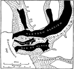
Marjelen Lake
Diagrammatic section of the Marjelen Lake, the Aletsch Glacier which holds it and the valley of the…
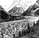
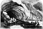
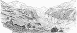
The Mer de Glace
One of the best known of the European glaciers is that of Mer de Glace (Sea of Ice). It descends…
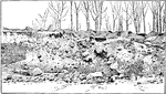
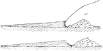
Section of Frontal Moraine
Section of frontal moraine on side of Warner Street, Glouchester, Massachusetts.
Lateral Moraine
In the valley glaciers, the rock fragments falling upon the ice from the valley sides, or sliding down…
Medial Moraine
Where two glacial streams unite, their adjoining lateral moraines become confluent and are continued…
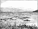
Terminal Moraines
Bird's eye view of about 2 square miles of terminal moraine. Lakes shown by horizontal shading; swamps…
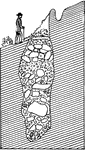
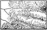
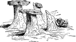
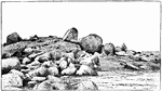
Roche Mountonnee
Rounded rock surfaces or Roches Mountonnees, due to erosion by a former glacier, Colorado.
Glaciers Topography Symbol
A conventional glacier topography symbol commonly used in drafting and map drawing.