
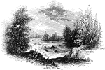
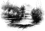
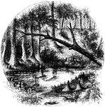
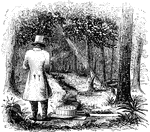
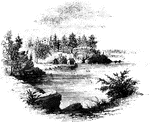
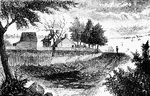
Pyle's Pond
"Pyle's Pond. About a quarter of a mile northwest from this pond, is the spot where the battle occurred.…
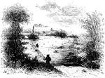
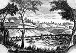
Trading Ford
"Trading Ford. This view of the Trading Ford, where greene, with Morgan and his light troops, crossed…
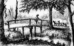
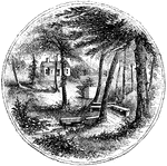
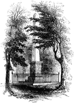
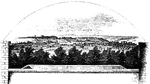
Guilford Battle-ground
"View of the battle-ground. This view is from the eminence southwest of the site of old Guilford Court…
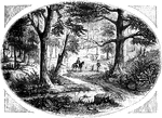
Tuckesege Ford
"View at Tuckesege Ford. This view is from the western bank of the Catawba, looking down the stream."—Lossing,…
King's Mountain Battle-Ground
"View at King's Mountain battle-ground. This view is from the foot of the hill, whereon the hottest…
Cowpens
"Scene at the Cowpens. This name is derived from the cirumstance that, some years prior to the Revolution,…

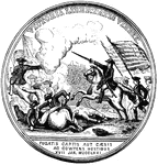
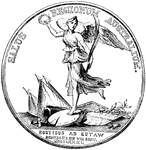
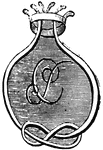
Morgan Medal Front
"Gold medal awarded to Morgan. The following are the devices and inscriptions upon the front of the…
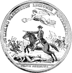
Morgan Medal Back
"Gold medal awarded to Morgan. The following are the devices and inscriptions upon the back of the medal:…

Howard Medal Front
"Silver medal awarded to Colonel Howard. The following are the device and inscriptions upon the front:…
Howard Medal Back
"Silver medal awarded to Colonel Howard. The following are the device and inscriptions upon the back:…
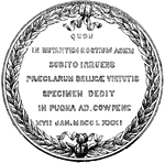
Washington Medal Front
"Silver medal awarded to Washington. The following are the device and inscriptions on the front: An…
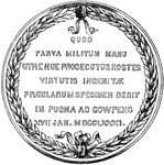
Washington Medal Back
"Silver medal awarded to Washington. The following are the device and inscriptions on the back: Quod…
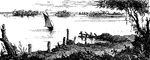
Cherokee Ford
"View at the Cherokee Ford. This view is from the east bank of the river. Toward the extreme right is…
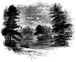
Catawba
"View of the Great Falls of the Catawba. This view is from the west side of the Catawba, looking northeast,…
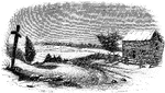
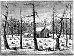
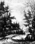
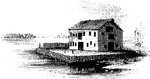
Rocky Mount
"View at Rocky Mount. This view is from the garden-gate at Mrs. Barkley's, looking northeast. On the…
Rugeley's
"View at Rugeley's. This view is from the south side of the bridge. The counterfeit cannon was placed…
Sander's Creek
"View at Sander's Creek. This view is from the north side of the Creek. like the other stream, it is…
Hobkirk's Hill
"View at the Spring; Hobkirk's Hill. It is at the hed of a ravine, scooped out of the northeastern slope…
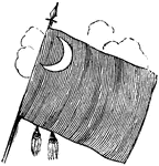
Eutaw Spring
"Eutaw Spring, where there was a conflict during the American Revolution."—Lossing, 1851

Greene Medal Front
"Gold medal awarded to Greene. This is a representation of the front side of the medal, the full size…
Greene Medal Back
"Gold medal awarded to Greene. This is a representation of the back side of the medal, the full size…
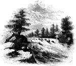
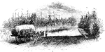
Nelson's Ferry
"View at Nelson's Ferry, the spot here portrayed, was an important locality during the Revolution. It…
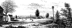
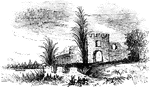
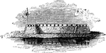
Fort Watson
"Site of Fort Watson."—Lossing, 1851 The Siege of Fort Watson was an American Revolutionary War confrontation…
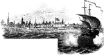
!["View from the site of Fort Cornwallis. Fort Cornwallis occupied the ground in the rear of the Episcopal church, now a grave-yard. This view is from within the inclosure, looking northeast, and includes a portion of Schultz's bridge, the Savannah River, and Hamburg upon the opposite bank. In the foreground is seen portions of the church-yard wall, and upon the brink of the river below are [African Americans] employed in placing bales of cotton upon the wharves for transportation to the sea-coast. The wharves are two stories in height, one to be used at low water, the other when the river is 'up.' There were remains of the ditch and embankments of the fort within the grave-yard when I was there; and the trench leading to the water-gate, where the 'Pride-of-India tree is seen, was very visible."—Lossing, 1851](https://etc.usf.edu/clipart/14100/14143/ft-cornwalli_14143_mth.gif)
Fort Cornwallis
"View from the site of Fort Cornwallis. Fort Cornwallis occupied the ground in the rear of the Episcopal…
Frederica
"Ruins of Oglethorpe's Barracks at Frederica. This is from a sketch made by W. W. Hazzard, Esq., in…
!["View of the remains of the French Works. These remains are in the southeastern suburbs of the city, about half way between the [African American] Cemetary and the residence of Major William Bowen, seen toward the right of the picture. The banks have an average height, from the bottom of the ditch, of about five feet, and are dotted with pines and chincapins or dwarf chestnuts, the former draped with moss. The ground is an open common, and although it was mid-winter when I was there, it was covered with green grass, bespangled with myriads of little flowers of stellar form. This view is from the direction of the town looking southeast."—Lossing, 1851](https://etc.usf.edu/clipart/14100/14147/french-works_14147_mth.gif)
French Works
"View of the remains of the French Works. These remains are in the southeastern suburbs of the city,…
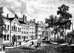
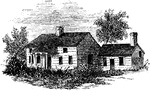
McIntosh's House
"Dwelling of General McIntosh. This house is the third eastward from Drayton Street, and is said to…
Fort Moultrie
"View at Fort Moultrie. This view is from the southwestern angle of Fort Sullivan, looking toward Jame's…
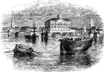
Turtle Bay
"View at Turtle Bay. Turtle Bay is a small rock-bound cove of the East River, at the foot of Forty-seventh…
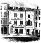
Broadway
"View at the foot of Broadway. General Charles Lee's troops marched to New York."—Lossing, 1851
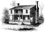
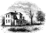
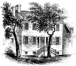
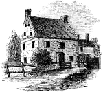
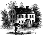
Washington's Head-Quarters
"Washington's head-quarters. I was informed by the venerable Anna van Antwerp, about a fortnight before…
Gravesend Bay
"View at Gravesend Bay. This view is from the road on the high shore, a little below Fort Hamilton,…
Cortelyou's House
"Cortelyou's House. This house, built of stone, with a brick gable from eaves to peak, is yet (1852)…
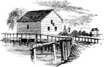
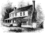
Brower's Mill
"Brower's Mill. This is a view of the old mill of the Revolution, as it appeared when I made the sketch…
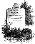
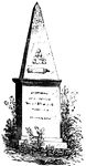
Woodhull's Grave
"Woodhull's Grave. Nathaniel Woodhull was born at Mastic, Long Island, December 30, 1722. Agriculture…
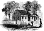
Washington's Head-Quarters
"Washington's head-quarters. The house occupied by Washington while the army was at White Plains is…
Bronx
"Place where the British crossed the Bronx. This view is from the southeastern side of the Bronx, a…