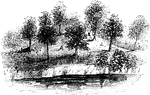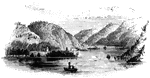
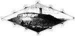
Roger's Rock. This sketch is from the lake, a little south of Cook's Point, seen just over the boat on the left. Immediately beyond is seen the smooth rock. Nearly opposite the 'slide' is Anthony's Nose, a high, rocky promontory, having the appearance of a human nose in shape when viewed from a particular point.

Roger's Rock

Roger's Rock. This sketch is from the lake, a little south of Cook's Point, seen just over the boat…
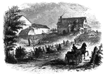
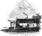
Site of Fort Anne. This view is from the bridge which crosses Wood Creek, looking south. The distant building on the right is the dwelling of Mr. Moore. Nearer is his store-house, and on the left are his out-houses. The fence, and so on to the barns and in their yards.

Fort Anne

Site of Fort Anne. This view is from the bridge which crosses Wood Creek, looking south. The distant…
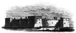
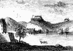
Fort at Chambly, this is a view of the south and west sides of the fort, looking toward the river. It stands directly upon the Richelieu, at the foot of the Chambly Rapids, and at the head of the navigation of the river up from the St. awrence. it is strongly built of stone, and, as seen in the picture, is in a state of excellent preservation.

Fort at Chambly

Fort at Chambly, this is a view of the south and west sides of the fort, looking toward the river. It…
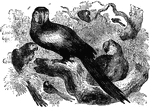
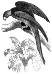
A group of macaws, a species of parrots native to South America.

Macaws

A group of macaws, a species of parrots native to South America.

The Carolina parrot is native to Guiana, but can be found as far north as Virginia. They often travel in flocks of thirty or forty, roosting together inside of hollow trees.

Carolina Parrot

The Carolina parrot is native to Guiana, but can be found as far north as Virginia. They often travel…
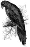
Native to South America, the parakeet macaw is renowned for its powers to imitate human speech.

Parakeet Macaw

Native to South America, the parakeet macaw is renowned for its powers to imitate human speech.
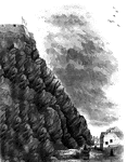
Cape Diamond, this is a view of the spot where Montgomery was killed. The cliff is Cape Diamond, crowned with the citadel. The street at the foot of it is called Champlain, and is inhabited chiefly by a mixed population of French, Canadians, and Irish. It extends from Mountain Street south almost to Wolfe's Cove. This view is from Champlain Street, a few rods south of <em>Pres de Ville</em>, looking north. High upon the rocks Alfred Hawkins, Esq., of Quebec, has placed a board with this inscription: "Here Major-General Montgomery Fell, December 31st, 1775."

Cape Diamond

Cape Diamond, this is a view of the spot where Montgomery was killed. The cliff is Cape Diamond, crowned…
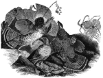
Known as the <em>partridge</em> in the Eastern States and as the <em>pheasant</em> in the South, the ruffled grouse is found throughout the United States, where it prefers to make its home at higher elevations.

Ruffled Grouse

Known as the partridge in the Eastern States and as the pheasant in the South, the…

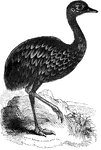
Found in Southern Pantagonia, the Pantagonian rhea's plumage is of a dark, mottled color.

Pantagonian Rhea

Found in Southern Pantagonia, the Pantagonian rhea's plumage is of a dark, mottled color.
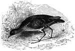
Also known as the Carolina rail, soree rail, and the English rail, the common American rail is found in the temperate wetlands of the United States.

Common American Carolina Rail

Also known as the Carolina rail, soree rail, and the English rail, the common American rail is found…
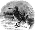
Ranging as far north as Scandanavia, Iceland, and Greenland in the summer, the European snipe migrates as far south as Egypt and Asia minor during the winter months.

European Snipe

Ranging as far north as Scandanavia, Iceland, and Greenland in the summer, the European snipe migrates…
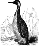
Also known as the pantagonian penguin, the king penguin is found in the far southern latitudes of South America and surrounding islands.

King Penguin

Also known as the pantagonian penguin, the king penguin is found in the far southern latitudes of South…
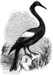
Also known as the snake-bird, the anhinga inhabits the freshwater areas of the South Atlantic States; also in South America as far south as Brazil.

Anhinga

Also known as the snake-bird, the anhinga inhabits the freshwater areas of the South Atlantic States;…
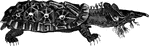
Primarily nocturnal, the matamata tortoise of South America feeds on small reptiles and fish.

Matamata tortoise

Primarily nocturnal, the matamata tortoise of South America feeds on small reptiles and fish.
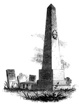
Caldwell's monument. The following are the inscriptions upon the Caldwell monument: East Side: "This monument is erected to the memory of the Rev. James Caldwell, the pious and fervent Christian, the zealous and faithful minister, the eloquent preacher, and a prominent leader among the worthies who secured the independence of his country. His name will be cherished in the church and in the state so long as Virtue is esteemed and Patriotism honored." West Side: "Hannah, wife of the Rev. James Caldwell, and daughter of Johnathan Ogden, of Newark, was killed at Connecticut Farms by a shot from a British soldier, June 25th, 1780, cruelty sacrificed by the enemies of her husband and of her country." North Side: "The memory of the just is blessed. Be of good courage- and let us behave ourselves valiant for our people, and for the cities of our God, and let the Lord do that which is good in his sight. The glory of children are their fathers." South Side: "James Caldwell. Born in Charlotte county, in Virginia, April, 1734. Graduated at Princeton College, 1759. Ordained pastor of the First Presbyterian Church of Elizabethtown, 1762. After serving as chaplain in the army of the Revolution, and acting as commissary to the troops in New Jersey, he was killed by a shot from a sentinel at Elizabethtown Point, November 24th, 1781."

Caldwell's Monument

Caldwell's monument. The following are the inscriptions upon the Caldwell monument: East Side: "This…
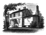
Liberty Hall. Some time after the death of Governor Livingston this property was purchased by Lord Blingbroke, who, under the assumed name of John Belesis, ran away from England with a daughter of Baron Hompasch, a German general. She was at a boarding school there, and Bolingbroke had a wife living. He married the girl here. She died in England in 1848. The grandmother of the present proprietor, Susan, the daughter of Peter Van Burgh Livingston, bought the farm of Lord Bolingbroke, and it has been in possession of the family ever since. Her first husband was John Kean, a member of Congress from South Carolina from 1785 to 1787, and was first cashier of the first United States Bank, chartered by an act of Congress passed February 8th, 1791. Her second husband was Count Niemcewicz, a Polish nobleman.

Liberty Hall

Liberty Hall. Some time after the death of Governor Livingston this property was purchased by Lord Blingbroke,…
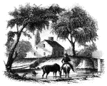
Head-quarters of Agnew and Erskine. This house is on the south bank of Still River, at the north end of the main street. It was built by Benjamind Knapp, in 1770, and was owned by him at the time of the invasion. His birth-place is also standing, on the north side of the river. They were among the few houses not burned. At the bridge seen on the right the British planted a cannon, and kept a strong guard there until their departure. This house is now (1848) owned by Noah Knapp.

Agnew and Erskine

Head-quarters of Agnew and Erskine. This house is on the south bank of Still River, at the north end…
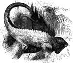
A large lizard, the common iguana is common to the tropical regions of the Americas. It spends much of its time in trees.

Common iguana

A large lizard, the common iguana is common to the tropical regions of the Americas. It spends much…
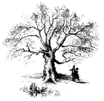
The Charter Oak. This venerable relic is still virgorous, and is a "gnarled oak" indeed. It stands upon the northern slope of the Wyllys Hill, a beautiful elevation on the south side of charter Street, a few rods east of Main Street. This engraving is from a sketch which I made of the tree from Charter Street, on the 3d of October, 1848. I omitted the picket fence in front, in order to show the appearance of the whole trunk.

Charter Oak

The Charter Oak. This venerable relic is still virgorous, and is a "gnarled oak" indeed. It stands upon…
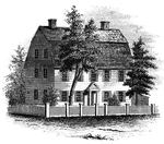
The Webb House. This house is still standing (1848), in the central part of Wethersfield, a few rods south of the Congregational Church.

Webb House

The Webb House. This house is still standing (1848), in the central part of Wethersfield, a few rods…

The old Colony Seal.

Colony Seal

The old Colony Seal.

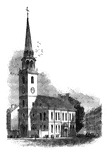
"The Old South. This venerable and venerated edifice, that stood through all the storms of the Revolution, and yet remains, stands on the corner of Washington and Milk Streets. It is of brick, and was erected in 1729-30, upon the site of an edifice built by the Pedo-baptists in 1669. The ancient church was of cedar, two stories high, with a steeple, gallery, and pews. The 'Old South' was the famous gathering-place of the people during the excitements of 1773. The British troops occupied it as a circus for the drill of cavalry in 1775, after removing all the wood-work within, except the eastern gallery and the pulpit and sounding-board. The British officers felt no compunctions in thus desecrating a Presbyterian chapel. It was repaired in 1782, and remains a fine model of our early church architecture. This view is from Washington Street."&mdash;Lossing, 1851

Old South

"The Old South. This venerable and venerated edifice, that stood through all the storms of the Revolution,…
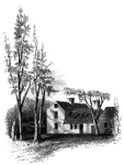
"Clark's House, Lexington. This building was standing when I visited Lexington in 1848. It was built by Thomas Hancock, Esq., of Boston, as a parsonage for his father, the Reverend John Hancock, of Lexington, about 130 years ago. Mr. Hancock was a minister at Lexington fifty-two years, and was succeeded by the Reverend Jonas Clark, the occupant of the house at the time of the skirmish at Lexington. Mr. Clark lived in the house fifty-two years. The room in which the two patriots, Samuel Adams and John Hancock, were sleeping on the night before the skirmish at Lexington, is retained in its original condition. The wainscoting is of Carolina pine, and the sides of the room are covered with a heavy paper, with dark figures, pasted upon the boards in rectangular pieces about fourteen inches square. In an adjoining room is one of those ancient fire-places, ornamented with pictorial tiles, so rarely found in New England."&mdash;Lossing, 1851

Clark's House

"Clark's House, Lexington. This building was standing when I visited Lexington in 1848. It was built…
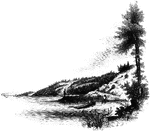
"Landing-place of Roger Williams. This view is on the left bank of the Seekonk, looking south. The point on which the figure stands is the famous rock, composed of a mass of dark slate, and rising but little above the water at high tide. The high banks are seen beyond, and on the extreme left is India Point, with the rail-road bridge near the entrance of the river into Narraganset Bay."&mdash;Lossing, 1851

Williams landing-place

"Landing-place of Roger Williams. This view is on the left bank of the Seekonk, looking south. The point…
"Top of Tonomy Hill. This view is from the northside of the hill, looking south. The wall appearance is a steep precipice of huge masses of pudding-stone, composed of pebbles and larger smooth stones, ranging in size from a pea to a man's head. It is a very singular geological formation. In some places the face is smooth, the stones, and pebbles appearing as if they had been cut with a knife while in a pasty or semi-fluid state. On the top of this mound are traces of the breast-works that were thrown up, not high, for the rocks formed a natural rampart, on all sides but one, against an enemy, Here Miantonomoh had his fort, and here his councils were held when he planned his expeditions agains the Mohegans. The observatory is a strong frame covered with lattice-work. On the right is seen the city of Newport in the distance."&mdash;Lossing, 1851

Tonomy Hill

"Top of Tonomy Hill. This view is from the northside of the hill, looking south. The wall appearance…
"Hubbard's House and Mill. The inscriptions upon the monument are as follows: East Side: "Oliver Hazard Perry. At the age of 27 years he achieved the victory of Lake Erie September 10, 1813.' North Side: 'Born in South Kingston, R. I., August 23rd, 1785. Died at Fort Spain, Trinidad, August 23d, 1819, aged 34 years.' West Side: 'His remains were conveyed to his native land in a ship of war, according to a resolution of Congress, and were here interred, December 4, 1826.' South Side: 'Erected by the State of Rhode Island.'"—Lossing, 1851

Hubbard's House and Mill

"Hubbard's House and Mill. The inscriptions upon the monument are as follows: East Side: "Oliver Hazard…
"West Point in 1780. This view is from a print published in the <em>New York Magazine</em> for 1790. It was taken from Constitution Island. On the left is seen a portion of old Fort Constitution. The great chain, four hundred and fifty yards in length, and covered by a strong battery, is seen stretched across the river, immediately below Fort Clinton, the structure on the high point. In the distance, on the left, two mountain summits are seen, crowned with fortifications. These were the North and Middle Redoubts. Upon the range of the Sugar Loaf Mountain, higher than these, and hidden, in the view, by Fort Clinton, was another redoubt, called the South Battery."—Lossing, 1851

West Point

"West Point in 1780. This view is from a print published in the New York Magazine for 1790.…
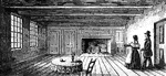
"The Breakfast Room. This is a view of the room in the Robinson House in which Arnold was at breakfast when he received Colonel Jameson's letter announcing the arrest of Andre. It is preserved in its original style, which is quite antique. The ceiling is low; the heavy beams are bare; the fire-place surrounded with neat panel-work, without a mantel-shelf. The door on the right opens into a small room which Arnold used as an office; the windows on the left open upon the garden and lawn on the south."&mdash;Lossing, 1851

Breakfast Room

"The Breakfast Room. This is a view of the room in the Robinson House in which Arnold was at breakfast…
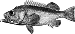
"Is twelve to twenty-four inches long; found in the northern seas, south to the coast of Massachusetts; it is tolderable food; the spines are used in Greenland for needles." &mdash; Goodrich, 1859

Bergylt

"Is twelve to twenty-four inches long; found in the northern seas, south to the coast of Massachusetts;…
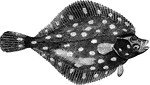
"Weighing six to twelve pounds; it feeds on mollusca, crustacea, and young fish; inhabits sandy banks and muddy grounds in the seal is sometime staken with hooks and sometimes with spears, though more generally with trawl-nets." &mdash; Goodrich, 1859

Plaice

"Weighing six to twelve pounds; it feeds on mollusca, crustacea, and young fish; inhabits sandy banks…
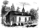
"Ancient Dutch Church in Sleepy Hollow. This view is from the church-yard, looking southwest. The porch seen on the right fronts upon the highway, and is a modern addition, the ancient entrance being on the south side. This is believed to be the oldest church in existence in this state, having been erected, according to inscription upon a stone tablet upon its front, by Vredryck Flypsen (Frederic Philips) and Catharine his wife, in 1699. It is built of brick and stone, the former having been imported from Holland for the express purpose. The old flag-shaped vane, with the initials of the founder cut out of it, yet turns upon its steeple, and in the little tower hangs the ancient bell, bearing this inscription: 'Si. Deus. Pro. Nobis. Quis. Contra. Nos. 1685.' The pulpit and communion-table were imported from Holland; the latter alone has escaped the ruthless hand of modern improvement."—Lossing, 1851

Sleepy Hollow Church

"Ancient Dutch Church in Sleepy Hollow. This view is from the church-yard, looking southwest. The porch…
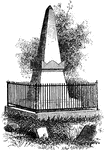
"Van Wart's monument. The following are the inscriptions upon this monument: North Side: 'Here repose the mortal remains of Isaac Van Wart, an elder in the Greenburgh church, who died on the 23d of May, 1828, in the 69th year of his age. Having lived the life, he died the death, of the Christian. South Side: 'The citizens of the county of West Chester erected this tomb in testimony of the high sense they entertained for the virtuous and patriotic conduct of their fellow-citizen, as a memorial sacred to public graditute.' East Side: 'Vincent, Amor Patriae. Nearly half a century before this monument was built, the conscript fathers of America had, in the Senate chamber, voted that Isaac Van Wart was a faithful patriot, one in whom the love of country was invincible, and this tomb bears testimony that the record is true.' West Side: 'Fidelity. On the 23d of September, 1780, Isaac Van Wart, accompanied by John Paulding and David Williams, all farmers of the county of West Chester, intercepted Major Andre, on his return from the American lines in the character of a spy, and, notwithstanding the large bribes offered them for his release, nobly disclaimed to sacrifice their country for gold, secured and carried him to the commanding officer of the district, whereby the dangerous and traitorous conspiracy of Arnold was brought to light, the insiduous designs of the enemy, baffled, the American army saved, and our beloved country free.'"—Lossing, 1851

Van Wart's Monument

"Van Wart's monument. The following are the inscriptions upon this monument: North Side: 'Here repose…
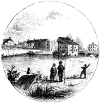
"Trenton Bridge and vicinity. This view is from the north side of the Assanpink, a few rods above the bridge, looking south. The bridge, seen upon the right, is built of stone, and very strong, and is upon the site of the old one. The creek is curbed by a dam near the bridge, and forms the sheet of water seen in the picture. The old 'Stacey Mill' of the Revolution, the largest building in the sketch, was quite dilapidated from the effects of fire and flood, when I was there. The two old houses on the left of it are of stone, covered with stucco, and were there at the time in question. On the bank, between them and the house of Mr. Timothy Abbott, seen on the extreme left, was a building used as a tavern, in the Revolution. It was demolished a few years ago. Along the high bank, from the mill eastward to the rail-way, now covered with houses and gardens, and also westward, some distance toward the Delaware, the Americans were encamped. The bank was being terraced when I visited Trenton, and will, in time, be a beautiful spot."&mdash;Lossing, 1851

Trenton

"Trenton Bridge and vicinity. This view is from the north side of the Assanpink, a few rods above the…
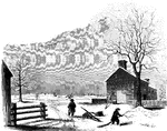
"View of the battle-ground near Princeton. This view, looking north, is from the carriage gate of Mr. John Clarke, owner of the house in which General Mercer died, which is situated about seventy rods from the Trenton turnpike. That dwelling is represented in the foreground of the picture, on the extreme right. The distant view includes almost the whole field of action. Near the center of the picture, over the head of the dark figure, is seen the house of William Clark, and his out-buildings. The barn, a little more to the left, with a tree in front, is upon the spot from whence Mercer rushed forward to the hedge-fence. That fence was upon the line of the present turnpike, denoted in the sketch by the fence passing down the slope beyond the large tree on the extreme left. The 'high ground' for which both parties were aiming, to secure advantage, is seen in the extreme distance. The dark spot between the tree in the second field and the barn denotes the spot where Mercer fell. The house of William Clark, in the distance, is about a quarter of a mile from the one in the foreground, where Mercer died. The hollow between the two houses was the space between the belligerents when Washington advanced to the support of Mercer. The place of conflict is about a mile and a quarter south of Princeton. The turnpike passes directly through it."&mdash;Lossing, 1851

Princeton battle-ground

"View of the battle-ground near Princeton. This view, looking north, is from the carriage gate of Mr.…
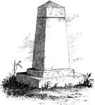
"Treaty Monument. This monument stands near the intersection of Hanover and Beach Streets, Kensington, on the spot where the celebrated <em>Treaty Tree</em> stood. The tree was blown down in 1810, when it was ascertained to be 283 years old. When the British were in possession of Philadelphia, during the winter of 1778, their foraging parties were out in every direction for fuel. To protect this tree from the ax, Colonel Simcoe, of the Queen's Rangers, placed a sentinel under it. Of its remains, many chairs, vases, work-stands, and other articles have been made. The commemorative monument was erected by the Penn Society. Upon it are the following inscriptions: North Side: 'Treaty ground of William Penn and the indian nation, 1682. Unbroken Faith.' South Side: 'William Penn, born 1644. Died, 1718.' West Side: 'Placed by the Penn Society, A. D. 1827, to mark the site of the great Elm Tree.' East Side: 'Pennsylvania founded, 1681, by deeds of Peace.'"&mdash;Lossing, 1851

Treaty Monument

"Treaty Monument. This monument stands near the intersection of Hanover and Beach Streets, Kensington,…
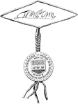
"Penn's Seal and Signature. This is a representation of the seal and signature of William Penn attached to the Pennsylvania charter. The names of the subscribing witnesses to the instrument are James Claypoole, Francis Plumsted, Thomas Barker, Philip Ford, Edward Pritchard, Andrew Soule, Christopher Taylor, Charles Lloyd, William Gibson, U. More, George Rudyard, Harbt. Springett."—Lossing, 1851

Penn's seal and signature

"Penn's Seal and Signature. This is a representation of the seal and signature of William Penn attached…
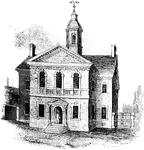
"Carpenters' Hall. This building is constructed of small imported bricks, each alternate one glazed, and darker than the other, giving it a checkered appearance. Many of the old houses of Philadelphia were built of ike materials. It was originally erected for the hall of meeting for the society of house-carpenters of Philadelphia. It stands at the end of an alley leading south from Chestnut Street, between Third and Fourth Streets."—Lossing, 1851

Carpenters' Hall

"Carpenters' Hall. This building is constructed of small imported bricks, each alternate one glazed,…
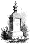
"Woodhull's Monument. This monument stands on the south side of the church. It is of white marble, about eight feet in height. The following is the inscription upon it: 'Sacred to the memory of the Reverend John Woodhull, D.D., who died Nov. 22d, 1824, aged 80 years. An able, faithful, and beloved minister of Jesus Christ. He preached the Gospel 56 years. He was settled first in Leacock, in Pennsylvania, and in 1779 removed to this congregation, which he served as pastor, with great diligence and success, for 45 years. Eminent as an instructor of youth, zealous for the glory of God, fervent and active in the discharge of all public and private duties, the labors of a long life have ended ina large reward.'"&mdash;Lossing, 1851

Woodhull's Monument

"Woodhull's Monument. This monument stands on the south side of the church. It is of white marble, about…
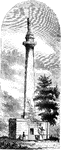
"Washington Monument. The following are the inscriptions on the monument: East front: 'To George Washington, by the State of Maryland. Born 23d February, 1732. Died 14th December, 1799.' South front: 'To George Washington, President of the United States, 4th March, 1789. Returned to Mount Vernon, 4th March, 1797.' West front: To George Washington. Trenton, 25th December, 1776. Yorktown, 19th October, 1781.' North Front: 'To George Washington. Commander-in-chief of the American armies, 15th June, 1775. Commission resigned at Annapolis, 23d December, 1783.'"—Lossing, 1851

Washington Monument

"Washington Monument. The following are the inscriptions on the monument: East front: 'To George Washington,…
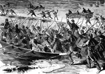
"'The Forlorn Hope.' Volunteers storming party, consisting of portions of the Seventh Michigan and Nineteenth Massachusetts crossing the Rappahannock in advance of the Grand Army, to drive off the Confederate riflemen who were firing upon the Federal pontioniers, Wednesday, December 10th, 1862. We illustrate one of those numerous acts of daring which have raised the character of the Federal soldier to the highest position in the military world. When the fire of the enemy from the rifle pits on the south side of the Rappahannock became so deadly that the pontoniers could not carry on their work, General Burnside called for 100 volunteers to cross and dislodge, at the bayonet's point, the concealed sharpshooters. Thousands sprang forward, but only the number required was chosen. These consisted of men from the Seventh Michigan and Nineteenth Massachusetts Regiments. With the utmost alacrity this gallant 'forlorn hope' sprang into the boats, and, on reaching the other side, drove the Confederates from their posts at the point of the bayonet, capturing 39 prisoners. Only one man was killed and give wounded in this desperate duty. The bridge was soon finished, and a sufficient force passed over to hold the town."&mdash; Frank Leslie, 1896

The Forlorn Hope

"'The Forlorn Hope.' Volunteers storming party, consisting of portions of the Seventh Michigan and Nineteenth…
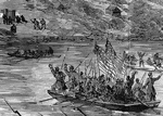
"'The Forlorn Hope.' Volunteers storming party, consisting of portions of the Seventh Michigan and Nineteenth Massachusetts crossing the Rappahannock in advance of the Grand Army, to drive off the Confederate riflemen who were firing upon the Federal pontioniers, Wednesday, December 10th, 1862. We illustrate one of those numerous acts of daring which have raised the character of the Federal soldier to the highest position in the military world. When the fire of the enemy from the rifle pits on the south side of the Rappahannock became so deadly that the pontoniers could not carry on their work, General Burnside called for 100 volunteers to cross and dislodge, at the bayonet's point, the concealed sharpshooters. Thousands sprang forward, but only the number required was chosen. These consisted of men from the Seventh Michigan and Nineteenth Massachusetts Regiments. With the utmost alacrity this gallant 'forlorn hope' sprang into the boats, and, on reaching the other side, drove the Confederates from their posts at the point of the bayonet, capturing 39 prisoners. Only one man was killed and give wounded in this desperate duty. The bridge was soon finished, and a sufficient force passed over to hold the town."&mdash; Frank Leslie, 1896

The Forlorn Hope

"'The Forlorn Hope.' Volunteers storming party, consisting of portions of the Seventh Michigan and Nineteenth…
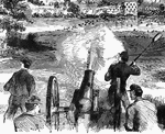
"Battle at Dam No. 4, Potomac River, between Butterfield's brigade and a large Confederate force. A desperate and disastrous action occurred on the banks of the Potomac, at Dam No. 4. General Butterfield's brigade, consisting of the Forty-fourth New York, Seventeenth New York, Eighteenth Massachusetts and One Hundred and Eighteenth Pennsylvania, were ordered to make a reconnoissance on the Virginia side. Crossing over at Dam No. 4, which is about six miles northwest in a straight line from Sharpsburg, and eight south from Williamsport, they had hardly landed when a most murderous fire was opened upon them from an entire division of the Confederate army, every volley of which told, as they had the Federals completely under range. The Federals made a desperate resistance, but they were compelled to retire before superior numbers, and retreated in moderate order across the river." &mdash;Leslie, 1896

Battle at Dam No. 4

"Battle at Dam No. 4, Potomac River, between Butterfield's brigade and a large Confederate force. A…
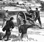
"Battle at Dam No. 4, Potomac River, between Butterfield's brigade and a large Confederate force. A desperate and disastrous action occurred on the banks of the Potomac, at Dam No. 4. General Butterfield's brigade, consisting of the Forty-fourth New York, Seventeenth New York, Eighteenth Massachusetts and One Hundred and Eighteenth Pennsylvania, were ordered to make a reconnoissance on the Virginia side. Crossing over at Dam No. 4, which is about six miles northwest in a straight line from Sharpsburg, and eight south from Williamsport, they had hardly landed when a most murderous fire was opened upon them from an entire division of the Confederate army, every volley of which told, as they had the Federals completely under range. The Federals made a desperate resistance, but they were compelled to retire before superior numbers, and retreated in moderate order across the river." &mdash;Leslie, 1896

Battle at Dam No. 4

"Battle at Dam No. 4, Potomac River, between Butterfield's brigade and a large Confederate force. A…
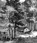
"The Battle of Cross Keys- opening of the fight- the federal troops, under General Fremont, advancing to attack the Confederate army under General Jackson, June 8th, 1862. By one of those singular chances which have made the conventional day of rest the day of famous battles, on the morning of Sunday, June 8th, 1862, the advance of General Fremont's army came up with the Confederate forces at cross Keys, about six miles to the south of Harrisonburg." &mdash; Frank Leslie, 1896

Battle of Cross Keys

"The Battle of Cross Keys- opening of the fight- the federal troops, under General Fremont, advancing…
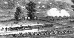
"The Battle of Cross Keys- opening of the fight- the federal troops, under General Fremont, advancing to attack the Confederate army under General Jackson, June 8th, 1862. By one of those singular chances which have made the conventional day of rest the day of famous battles, on the morning of Sunday, June 8th, 1862, the advance of General Fremont's army came up with the Confederate forces at cross Keys, about six miles to the south of Harrisonburg." &mdash; Frank Leslie, 1896

Battle of Cross Keys

"The Battle of Cross Keys- opening of the fight- the federal troops, under General Fremont, advancing…
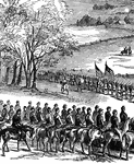
"The Battle of Cross Keys- opening of the fight- the federal troops, under General Fremont, advancing to attack the Confederate army under General Jackson, June 8th, 1862. By one of those singular chances which have made the conventional day of rest the day of famous battles, on the morning of Sunday, June 8th, 1862, the advance of General Fremont's army came up with the Confederate forces at cross Keys, about six miles to the south of Harrisonburg." &mdash; Frank Leslie, 1896

Battle of Cross Keys

"The Battle of Cross Keys- opening of the fight- the federal troops, under General Fremont, advancing…
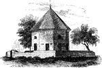
"The Old Magazine. This view is from the square, looking southeast. South of it is a neat frame building, which was occupied by President Tyler before his election to the office of Vice-president of the United States."&mdash;Lossing, 1851

Old Magazine

"The Old Magazine. This view is from the square, looking southeast. South of it is a neat frame building,…
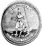
"Great Seal of Virginia."&mdash;Lossing, 1851

Virginia Seal

"Great Seal of Virginia."—Lossing, 1851

"This is a view from the lawn, looking south. It is a frame building with a brick foundation. At the time of the siege it belonged in fee to Governor Nelson, but its occupant, a widow Moore, had a life interest in it, and it was known as Moore's house. The narrow piazza in front is a modern addition. This house is upon the Temple Farm, so called from the fact that vestiges of a small temple or church, and the remains of an ancient settlement, are there seen, about a mile and a half south of Yorktown. Around the temple was a wall, and within are several tomb-stones. One of these bear the name of Major William Gooch, and the date of his death, 1655."&mdash;Lossing, 1851

Moore's House

"This is a view from the lawn, looking south. It is a frame building with a brick foundation. At the…
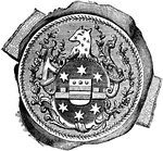
"Seal and signature of Tryon. William Tryon was a native of Ireland, and was educated to the profession of a soldier. He was an officer in the British service. He married Miss Wake, a relative of the Earl of Hillsborough, secretary for the colonies. Thus connected, he was a favorite of government, and was appointed lieutenant governor of North Carolina, in 1765. On the death of Governor Dobbs, he succeeded him in office, and exercised its functions until called to fill the same office in New York, in 1771. The history of his administration in North Carolina is a record of extortion, folly, and crime. During his administration in New York, the Revolution broke out, and he was the last royal governor of that state, though nominally succeeded in office in 1780 by General Robertson, when he was returned to England. His property in North Carolina and in New York was confiscated."—Lossing, 1851

William Tryon Seal

"Seal and signature of Tryon. William Tryon was a native of Ireland, and was educated to the profession…
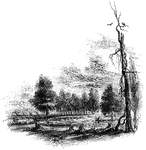
"The Regulator battle-ground. This view is from the south side of the Salisbury Road, which is marked by the fence on the left. The belligerents confronted in the open field seen on the north of the road, beyond the fence. Between the blasted pine, to which a muscadine is clinging, and the road, on the edge of a small morass, several of those who were slain in that engagement were buried. I saw the mounds of four graves by the fence, where the sheep, seen in the picture, are standing. The tree by the road side is a venerable oak, in which are a few scars produced by the bullets."&mdash;Lossing, 1851

Regulator Battle-ground

"The Regulator battle-ground. This view is from the south side of the Salisbury Road, which is marked…
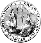
"Great Seal of the State of North Carolina."&mdash;Lossing, 1851

North Carolina Seal

"Great Seal of the State of North Carolina."—Lossing, 1851

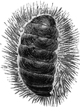
"The <em>Chiton spinosus</em> is bordered by long, black, aculeted spines; found in the South Seas; length three inches." &mdash; Goodrich, 1859

Chiton spinosus

"The Chiton spinosus is bordered by long, black, aculeted spines; found in the South Seas;…
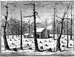
"Scene at the Cowpens. This name is derived from the cirumstance that, some years prior to the Revolution, before this section of country was settled, some persons in Camden (then called Pine-tree) employed two men to go up to the Thicketty Mountain, and in the grassy intervales among the hills, raise cattle. As a compensation, they were allowed the entire use of the cows during the summer for making butter and cheese, and the steers for tilling labor. In the fall, large numbers of the fattest cattle would be driven down to Camden to be slaughtered for beef, on account of the owners. This region, so favorable for rearing cows, on account of the grass and fine springs, was consequently called <em>The Cowpens</em>. The field was covered with blasted pines, stumps, and stocks of indian corn, and had a most dreary appearance."&mdash;Lossing, 1851

Cowpens

"Scene at the Cowpens. This name is derived from the cirumstance that, some years prior to the Revolution,…
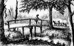
"View at Rugeley's. This view is from the south side of the bridge. The counterfeit cannon was placed in the road where the first wagon is seen. The house and barn of Rugeley were in the cleared field seen beyond the wagons."—Lossing, 1851

Rugeley's

"View at Rugeley's. This view is from the south side of the bridge. The counterfeit cannon was placed…
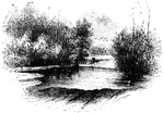
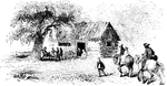
"View at Gum Swamp. This view is from the south side of the stream."—Lossing, 1851

Gum Swamp

"View at Gum Swamp. This view is from the south side of the stream."—Lossing, 1851

"A southern school-house during the American Revolution."&mdash;Lossing, 1851

Southern School-House

"A southern school-house during the American Revolution."—Lossing, 1851

"Site of Fort Watson."—Lossing, 1851

<p>The Siege of Fort Watson was an American Revolutionary War confrontation in South Carolina that began on April 15, 1781 and lasted until April 23, 1781. Continental Army forces under Henry "Light Horse Harry" Lee and South Carolina militia under Francis Marion besieged Fort Watson, a fortified British outpost that formed part of the communication and supply chain between Charleston and other British outposts further inland.

<p>The attackers, lacking artillery, were unable to make a dent in the fortified works, and failed in attempts to deny the garrison of a water supply. They then devised a plan to build a tower from which sharpshooters could fire into the fort's walls. Fort Watson was once again attacked by the Americans on April 23, with the British forces unable to control the walls due to musket fire from the tower. They surrendered shortly afterwards.

Fort Watson

"Site of Fort Watson."—Lossing, 1851 The Siege of Fort Watson was an American Revolutionary War confrontation…
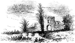
"Ruins of Oglethorpe's Barracks at Frederica. This is from a sketch made by W. W. Hazzard, Esq., in 1851. Mr. Hazzard writes: 'These ruins stand on the left bank or bluff of the south branch of the Alatamaha River, on the west side of St. Simon's Island, where the steamers pass from Savannah to Florida.' This fort was a scene of hostilities during the war of the Revolution, and also that of 1812; and is one of the most interesting military relics of our country. Mr. Hazzard states that, in his field in the rear of it, his men always turn up 'bomb-shells and hollow shot whenever they plow there.' The whole remains are upon his plantation at West Point."&mdash;Lossing, 1851

Frederica

"Ruins of Oglethorpe's Barracks at Frederica. This is from a sketch made by W. W. Hazzard, Esq., in…
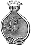
"Pulaski's seal."&mdash;Lossing, 1851

Pulaski's Seal

"Pulaski's seal."—Lossing, 1851