Maps Site map
  Maps > Europe > Austria-Hungary
Site Map  

  Record   11   to   15  of   15

A collection of historic and contemporary political and physical maps of Austria-Hungary, including early history and empire, boundary changes, and break up after WWI.
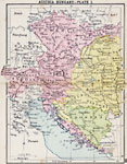
Austria-Hungary, 1920
A map showing the extent of the Austria–Hungary territories in 1920, showing districts, possessions, major cities and towns, railroads, rivers, and mountain systems in the region....

Austria-Hungary , 1920
First in a series of regional maps of Austria–Hungary showing the territories in 1920. The map shows major cities and towns, railroads, rivers, and mountain systems....

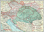
Austria-Hungary, 1920
Second in a series of regional maps of Austria–Hungary in 1920 showing the Austrian territory of Galicia and the eastern portion of Hungary (east of the Theiss or Tisza River), including Transylvania. The map shows major cities and towns, railr...

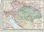
Austria-Hungary, 1920
A map of Austria–Hungary in 1920, showing railroads, canals, and submarine telegraph lines. This map shows the partition of the Austro–Hungarian territories after WWI, showing the new boundaries established by the Treaty of Saint Germaine...

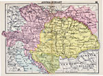
Austria and Hungary, 1920
A map of the former Austria–Hungary after the Treaty of Versailles following WWI, showing pre–war and post–war boundary changes. The map shows the new boundaries of Czechoslovakia and Jugoslavia, the losses to Poland, Ukraine, Roman...

First Previous


  Maps > Europe > Austria-Hungary
Site Map  

Maps ETC is a part of the Educational Technology Clearinghouse
Produced by the Florida Center for Instructional Technology © 2009
College of Education, University of South Florida