Maps Site map
  Maps > North America > Canada
Site Map  

  Record   71   to   80  of   156

Historic and contemporary maps of Canada including physical and political maps of provinces and territories, early exploration and settlement, climate, vegetation, battle plans, geomorphic, and automobile route maps.
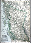
British Columbia, 1909
A map from 1909 of British Columbia showing the provincial capital of Victoria, major cities and towns, existing and proposed railroads, telegraph lines and submarine cables, mountains, lakes, rivers, coastal features, and islands....

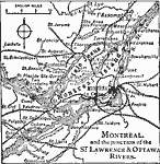
Montreal and the Junction of the St. Lawrence and Ottawa Rivers, 1909
A map from 1909 of Montreal at the confluence of the Ottawa and St. Lawrence Rivers and vicinity, showing the city, railroads, the Island of Montreal, Isle of Jesus, Perrot Island, Rivière des Prairies, Lake St. Francis and Lake St. Louis, and...

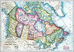
The Dominion of Canada and Newfoundland, 1910
A map from 1910 of the Dominion of Canada and Newfoundland (Newfoundland and Labrador were not part of the Canadian Confederation until 1949), showing the provinces at the time, provincial capitals, major cities, towns, and settlements, mountain syst...

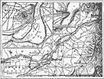
Montreal, Ottawa, and Quebec, 1910
A map from 1910 of the St. Lawrence Valley showing the Ottawa River from Ottawa to Montreal, and the St. Lawrence River from Cornwall north to Quebec. The map shows major cities and towns, and the railway network in the region. Inset maps detail the ...

Geology of Eastern Canada, 1911
A sketch map of eastern Canada showing the general location of different types of rocks in this part of Canada. Within the heavy black lines are found chiefly metamorphic and igneous rocks, and chiefly sedimentary rocks without. The Laurentian Penepl...

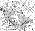
The Lake Region of North America, 1911
A map from 1911 showing the lake region of the Laurentian Plateau and adjacent areas, primarily north of the International boundary in the region known as the Canadian Shield. Only the principal lakes are shown. As indicated in the text, there are at...

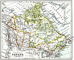
The Dominion of Canada, 1911
A map from 1911 of the Dominion of Canada showing the boundaries of the provinces and territories north to Grant Island above the Arctic Circle, major cities, existing and proposed railways, mountain systems, lakes, rivers, coastal features, and isla...

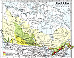
Canada, Railways and Economic Regions, 1911
A map from 1911 of Canada showing the principal economic regions, railway network, and shipping routes in the Great Lakes and Hudson Bay. The map is color–coded to show the industrial districts, agricultural lands, grazing lands, and forest lan...

Newfoundland and Gulf of St. Lawrence, 1911
A map from 1911 of the Gulf of St. Lawrence, Newfoundland, and the Maritime Provinces of New Brunswick, Prince Edward Island, and Nova Scotia. The map also shows coastal Quebec from the mouth of the St. Lawrence River, Gaspé, and Anticosti Isl...

New Brunswick, Nova Scotia, and Prince Edward Island, 1911
A map from 1911 of the Canadian Maritime Provinces of New Brunswick, Nova Scotia, and Prince Edward Island, showing the provincial capitals of Fredericton (New Brunswick), Halifax (Nova Scotia), and Charlottetown (Prince Edward Island), county bounda...

First Previous Next Last


  Maps > North America > Canada
Site Map  

Maps ETC is a part of the Educational Technology Clearinghouse
Produced by the Florida Center for Instructional Technology © 2009
College of Education, University of South Florida