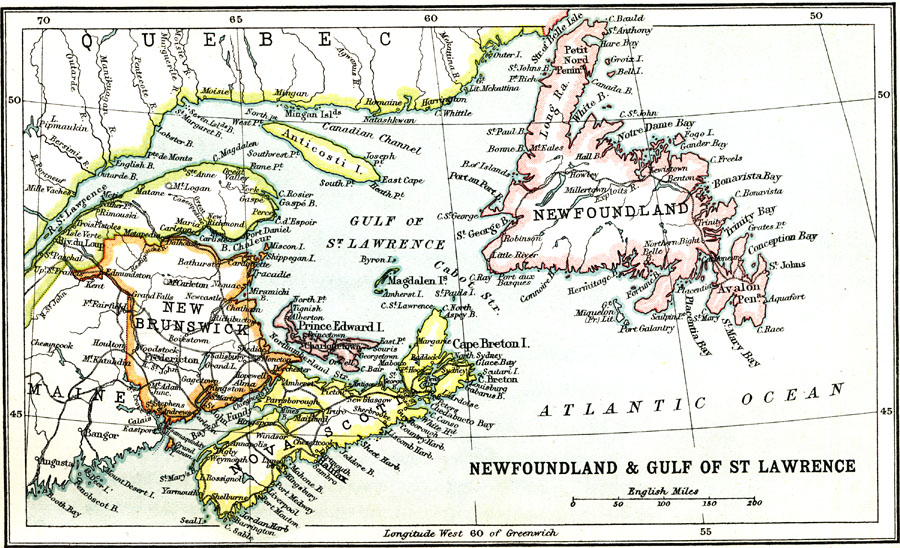
Description: A map from 1911 of the Gulf of St. Lawrence, Newfoundland, and the Maritime Provinces of New Brunswick, Prince Edward Island, and Nova Scotia. The map also shows coastal Quebec from the mouth of the St. Lawrence River, Gaspé, and Anticosti Island. The map shows the provincial capitals of Fredericton (New Brunswick), Halifax (Nova Scotia), Charlottetown (Prince Edward Island), and St. John (Newfoundland) major cities, towns, and ports, railways, coastal features and smaller islands.
Place Names: Canada, Nova Scotia, �Newfoundland, �New Brunswick, �Quebe
ISO Topic Categories: society
Keywords: Newfoundland and Gulf of St. Lawrence, physical, �political, physical features, country borders,
major political subdivisions, society, Unknown, 1911
Source: Ernest Rhys, Ed., A Literary and Historical Atlas of North & South America (New York, NY: E.P. Dutton & CO., 1911) 44
Map Credit: Courtesy the private collection of Roy Winkelman |
|