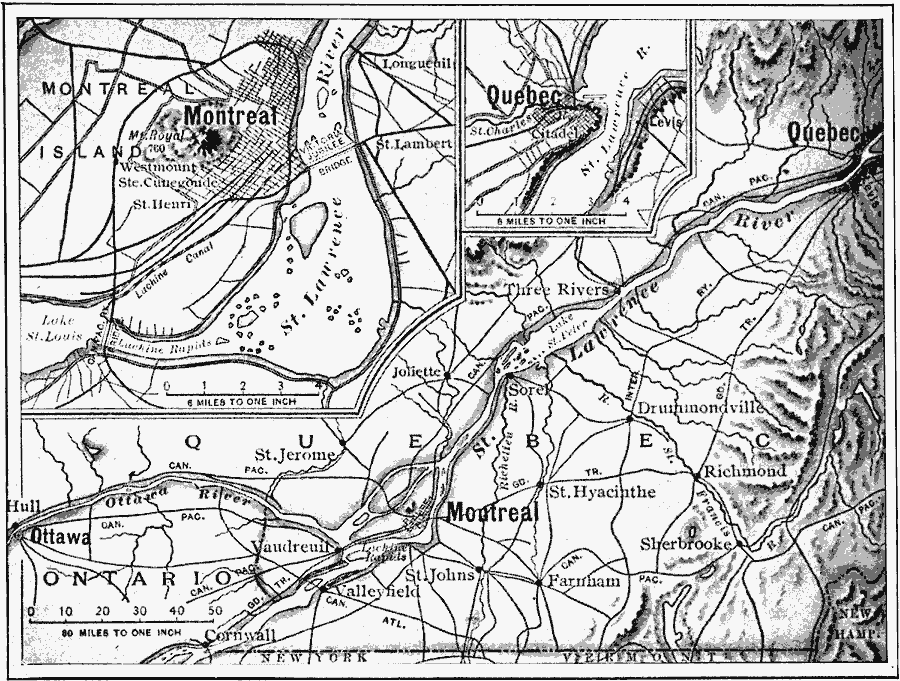
Description: A map from 1910 of the St. Lawrence Valley showing the Ottawa River from Ottawa to Montreal, and the St. Lawrence River from Cornwall north to Quebec. The map shows major cities and towns, and the railway network in the region. Inset maps detail the cities of Montreal and Quebec.
Place Names: Canada, Quebec, �Montreal, �Ottaw
ISO Topic Categories: inlandWaters,
location,
oceans
Keywords: Montreal, Ottawa, and Quebec, political, �physical, physical features, local jurisdictions,
major political subdivisions,
country borders, inlandWaters,
location,
oceans, Unknown, 1910
Source: Ralph S. Tarr, B.S., F.G.S.A. and Frank M. McMurry, Ph.D., New Geographies 2nd ed (New York, NY: The Macmillan Company, 1910) 168
Map Credit: Courtesy the private collection of Roy Winkelman |
|