Maps Site map
  Maps > North America > Cuba
Site Map  

  Record   1   to   9  of   9

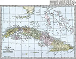
Historic and contemporary maps of Cuba for use in the K-12 classroom.

Cuba, 1898
A map from 1898 of Cuba: "the largest island of the West Indies. It is 720 miles long and averages 80 miles wide, and it has an area of 46,000 square miles. The surface, which is for the most part low and undulating, is broken by three distinct ...

Cuba, 1901
A map from 1901 of Cuba showing the provinces and provincial capitals, major cities and towns, railroads, rivers, terrain and coastal features, and smaller neighboring islands....

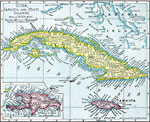
Cuba, Jamaica, and Haiti Islands, 1901
A map from 1901 of Cuba, Jamaica, and an inset of Hispaniola (Haiti and Santo Domingo or Dominican Republic), showing provinces and province capitals, major cities, towns and ports, railroads, terrain and coastal features, and smaller neighboring isl...

Cuba, 1909
A map from 1909 of Cuba and the Isle of Pines showing the provinces and provincial capitals, major cities and towns, railroads, submarine telegraph cable routes, rivers, terrain and coastal features, reefs, and smaller islands....

Cuba, 1912
A black and white map from 1912 of Cuba showing the provinces and provincial capitals, major cities and towns, railroads, submarine telegraph cable routes, rivers, terrain and coastal features, reefs, and smaller neighboring islands....

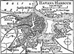
Havana Harbor, 1919
A map from 1919 of Havana and the Havana Harbor, showing the principal streets, districts of Cerro and Jesus del Monte, the neighboring Regla, railroads, government buildings, and castillos....

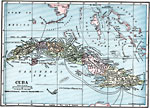
Cuba, 1919
A map from 1919 of Cuba and the Isle of Pines showing the provinces and provincial capitals, major cities and towns, railroads, submarine telegraph cable routes, rivers, terrain and coastal features, reefs, and smaller islands. The map shows the prox...

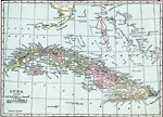
Cuba, 1920
A map from 1920 of Cuba showing the capital of Havana, provinces and provincial capitals, major cities and towns, railroads, rivers, terrain and coastal features, and smaller neighboring islands. The map shows Cuba's proximity to southern Florida and...

Cuba, 1920
A map from 1920 of Cuba showing the capital of Havana, provinces and provincial capitals, major cities and towns, railroads, rivers, terrain and coastal features, and smaller neighboring islands. The map shows Cuba's proximity to southern Florida and...


  Maps > North America > Cuba
Site Map  

Maps ETC is a part of the Educational Technology Clearinghouse
Produced by the Florida Center for Instructional Technology © 2009
College of Education, University of South Florida