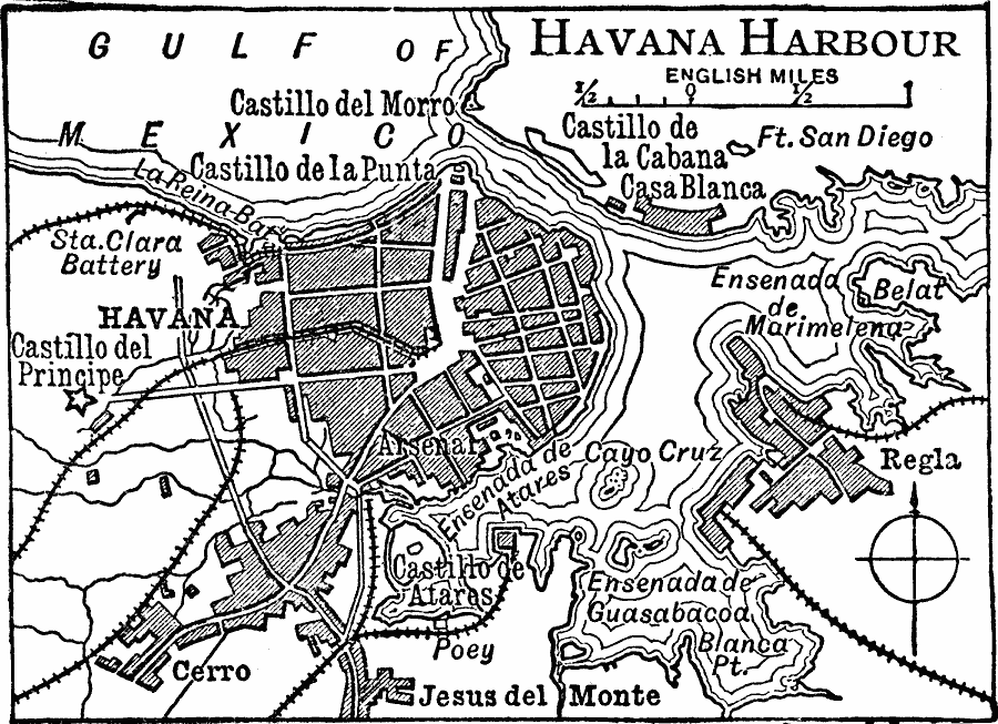
Description: A map from 1919 of Havana and the Havana Harbor, showing the principal streets, districts of Cerro and Jesus del Monte, the neighboring Regla, railroads, government buildings, and castillos.
Place Names: Cuba, Havan
ISO Topic Categories: transportation,
boundaries,
inlandWaters,
location,
oceans
Keywords: Havana Harbor, physical, �transportation, �political, physical features, local jurisdictions, railroads,
roads, transportation,
boundaries,
inlandWaters,
location,
oceans, Unknown, 1919
Source: Charles Morris, Winston's Cumulative Encyclopedia Vol 5 (Philadelphia, PA: The John C. Winston Company, 1919) tab 1
Map Credit: Courtesy the private collection of Roy Winkelman |
|
