|
|
|
| Maps > United States > Civil War |
A collection of historic maps of the American Civil War, including regional seats of the war, battle and campaign maps, and territories held by Confederate and Union forces.
|
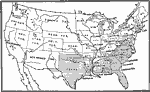
Territory held by the Confederates at the close of 1862,
1862 |
|
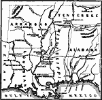
The War in the South and Southwest,
1862 |
|
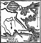
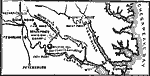
From New Orleans to the Gulf,
1862 |
|
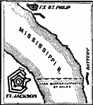
Forts Jackson and St. Philip,
1862 |
|
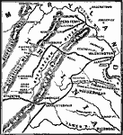
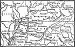
North Virginia–Shenandoah Valley,
1862 |
|
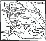
McClellan's Campaign against Richmond,
1862 |
|
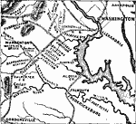
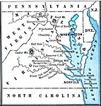
Pope's Retreat to Washington,
1862 |
|
Seven Days Fighting,
1862 |
|
Campaigns around Perryville Kentucky,
1862 |
|
State Secessions,
1862 |
| First | Previous | Next | Last |
| Maps > United States > Civil War |
Maps ETC is a part of the Educational Technology Clearinghouse
Produced by the Florida Center for Instructional Technology © 2009
College of Education, University of South Florida