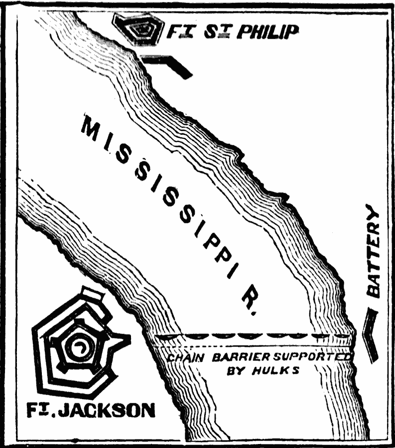
Description: A map of Fort Jackson and Fort St. Philip, two Confederate forts on the Mississippi River in Louisiana. The map shows the fortifications, batteries, and the chain barrier across the Mississippi. These forts were essential to the protection of New Orleans, but fell to the Union Navy in April, 1862, resulting in the capture of the city.
Place Names: Civil War, Ft. Jackson, �Ft. St. Philip, �Mississippi, ��Confederate territor
ISO Topic Categories: oceans,
location,
inlandWaters
Keywords: Forts Jackson and St. Philip, physical, �historical, �military, �war, �country borders, historical event, oceans,
location,
inlandWaters, Unknown, 1862
Source: David B. Scott, A School History of the United States, from the discovery of America to the year 1880. (New York, NY: American Book Company, 1884) 340
Map Credit: Courtesy the private collection of Roy Winkelman |
|