Maps Site map
  Maps > United States > Civil War
Site Map  

  Record   61   to   70  of   137

A collection of historic maps of the American Civil War, including regional seats of the war, battle and campaign maps, and territories held by Confederate and Union forces.
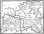
Confederate Line in Kentucky, 1862
A map of central Kentucky showing the Confederate territory in 1862. ":The opening of 1862 found the Confederates in possession of a strong line across the southern portion of Western Kentucky, stretching from Bowling Green, near the center of th...

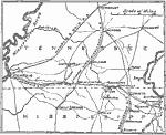
Memphis to Iuka, 1862
A map showing the area from Memphis, Tennessee, to Iuka, Mississippi, showing the operations of the Grant campaign (1862) during the American Civil War. The map shows the towns, roads and railroads, and rivers in the area, including the Mississippi a...

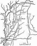
Memphis to Vicksburg, 1862–1863
A map showing the area between Memphis and Vicksburg on the Mississippi River during the Vicksburg Campaign of 1863. The map shows cities and towns, railroads, rivers, and terrain features of the area....

Virginia Campaigns, 1862–1865
The scenes of the Western campaigns, color-coded to differentiate between federal and confederate armies....

Campaign Against Vicksburg, 1863
The region surrounding Vicksburg, Mississippi in 1863, showing battle sites and fortifications during the Union campaign....

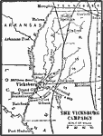
The Vicksburg Campaign, 1863
A map of the vicinity of Vicksburg ob the Mississippi River during the American Civil War showing the fortifications and siege line around Vicksburg, the strategic railroads in the area linking the port on the Mississippi, and the route of General Gr...

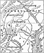
The War in the East, 1863
A map of southern Pennsylvania, Maryland, and northern Virginia showing the area of General Robert E. Lee's Northern Campaign in 1863. The map shows major cities, railroads, terrain, and rivers in the area. The goal of Lee's campaign, Harrisburg, Pen...

Vicksburg and Vicinity, 1863
The vicinity of Vicksburg, Mississippi during the American Civil War.The map shows the Mississippi River, strategic railroads, and Grant's advances through the area toward the seige and capture of Vicksburg....

Chattanooga Campaign, 1863
A detailed map of the area around Chattanooga, Tennessee, showing the region during the Chattanooga Campaign of the American Civil War in October–November, 1863. The map shows the state boundaries of Tennessee, Alabama, and Georgia, cities and ...

The War in the East, 1863
A map showing the major battle sites in the east in 1862–1863 during the American Civil War. The map shows major cities, rivers, and the sites of Fredericksburg, Chancellorsville, Wilderness, Spottsylvania, Mount Cedar, Mechanicsville, Cold Har...

First Previous Next Last


  Maps > United States > Civil War
Site Map  

Maps ETC is a part of the Educational Technology Clearinghouse
Produced by the Florida Center for Instructional Technology © 2009
College of Education, University of South Florida