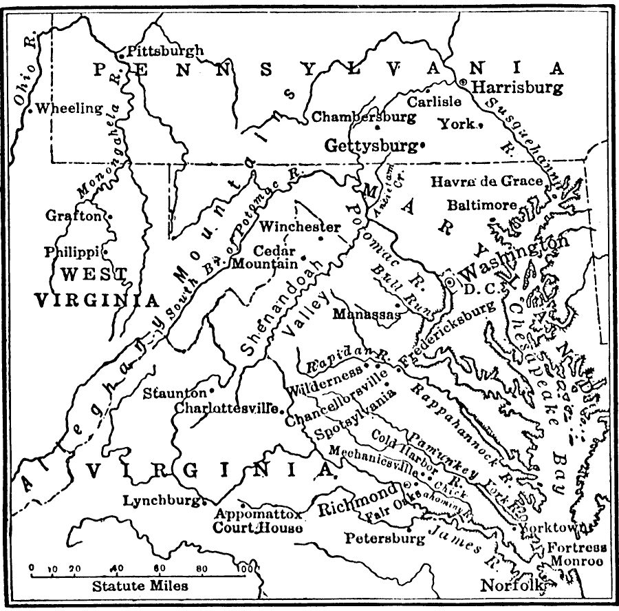
Description: A map showing the major battle sites in the east in 1862–1863 during the American Civil War. The map shows major cities, rivers, and the sites of Fredericksburg, Chancellorsville, Wilderness, Spottsylvania, Mount Cedar, Mechanicsville, Cold Harbor, Petersburg, Shenandoah Valley, and Gettysburg.
Place Names: Civil War, Allegheny mountains, �Chesapeake Bay, �Maryland, �Pennsylvania, �United States, �Virginia, �Washington D.C., �West Virginia,
ISO Topic Categories: oceans,
location,
inlandWaters,
boundaries
Keywords: The War in the East, borders, �historical, �land, �war, �physical features, historical event, oceans,
location,
inlandWaters,
boundaries, Unknown, 1863
Source: S.E. Forman, Advanced American History (New York, NY: The Century Company, 1919) 456
Map Credit: Courtesy the private collection of Roy Winkelman |
|