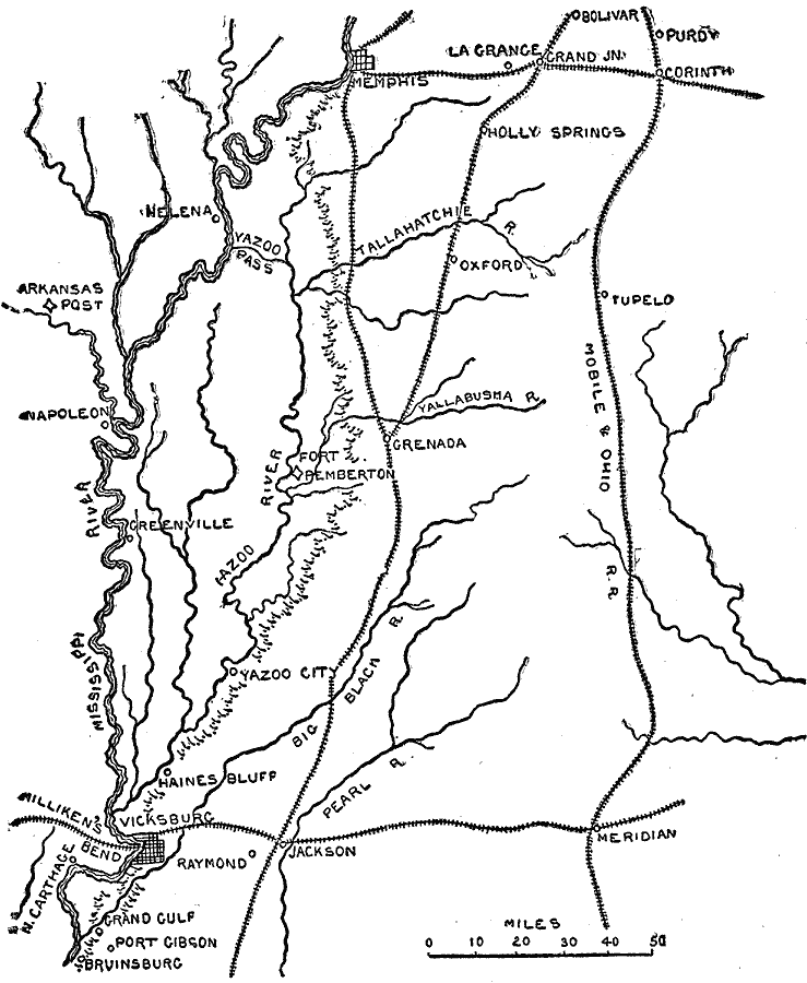
Description: A map showing the area between Memphis and Vicksburg on the Mississippi River during the Vicksburg Campaign of 1863. The map shows cities and towns, railroads, rivers, and terrain features of the area.
Place Names: Civil War, Memphis, Vicksburg, North Carthage, Bruinsburg, Port Gibson, Grand Gulf, Raymond, Haines Bluff, Jackson, Meridian, Tupelo, Corinth, Greenville, Napoleon, Arkansas Post, La Grange, Grand Junction, Bolivar, Purdy, Oxfor
ISO Topic Categories: inlandWaters,
location,
transportation
Keywords: Memphis to Vicksburg, physical, �political, �historical, �transportation, �memphis to vicksburg, physical features, roads,
railroads, Civil War, inlandWaters,
location,
transportation, Unknown, 1862–1863
Source: Theodore Ayrault Dodge, A Bird's-Eye View of our Civil War (Boston, MA: Houghton, Mifflin and Company, 1897) 96
Map Credit: Courtesy the private collection of Roy Winkelman |
|