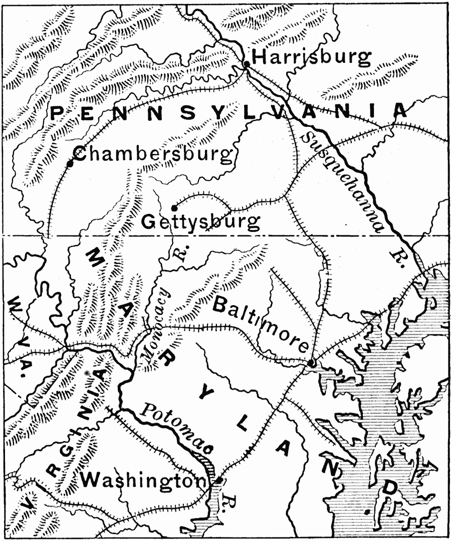
Description: A map of southern Pennsylvania, Maryland, and northern Virginia showing the area of General Robert E. Lee's Northern Campaign in 1863. The map shows major cities, railroads, terrain, and rivers in the area. The goal of Lee's campaign, Harrisburg, Pennsylvania, is shown, as well as the significant battle site of Gettysburg, which resulted in the withdrawal of the Confederates from the north.
Place Names: Civil War, Gettysburg, �Harrisburg, �Balitmore, �Washington D.C
ISO Topic Categories: boundaries,
location,
inlandWaters,
oceans,
intelligenceMilitary
Keywords: The War in the East, historical, �transportation, �physical, �political, physical features, major political subdivisions, railroads, Civil War, boundaries,
location,
inlandWaters,
oceans,
intelligenceMilitary, Unknown, 1863
Source: Edward Eggleston, The Household History of the United States and Its People (New York, NY: D. Appleton and Company, 1898) 323
Map Credit: Courtesy the private collection of Roy Winkelman |
|