|
|
|
| Maps > United States > New York |
A collection of historic and contemporary political and physical maps of New York, including early exploration and settlement maps, Revolutionary War maps, geophysical maps, and automobile route maps.

|
Niagara Frontier,
1815 |

|
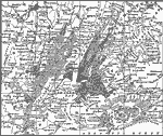
Greater New York and Vicinity,
1865–1898 |

|
New York Harbor,
1872 |
|
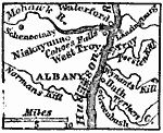
Albany and Vicinity,
1872 |

|
Vicinity of Lake George,
1872 |

|
Westchester County,
1872 |
|
Drawing New York,
1872 |
|
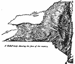
Relief of New York,
1872 |
|
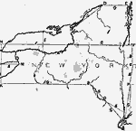
New York City and Vicinity,
1872 |

|
Central Park,
1881 |
| First | Previous | Next | Last |
| Maps > United States > New York |
Maps ETC is a part of the Educational Technology Clearinghouse
Produced by the Florida Center for Instructional Technology © 2009
College of Education, University of South Florida