|
|
|
| Maps > United States > South Carolina |
A collection of historic and contemporary political and physical maps of South Carolina for use in the K-12 classroom.
|
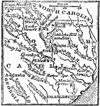
Seat of War in South Carolina,
1780 |
|
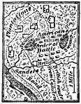
Battle of Sanders' Creek,
1780 |
|
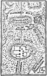
Battle of Hobkirk's Hill,
1781 |

|
Charleston and its Defenses,
1863 |

|
Vicinity of Charleston,
1872 |

|
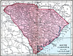
South Carolina,
1891 |
|
South Carolina,
1906 |

|
South Carolina,
1909 |
|
South Carolina,
1914 |

|
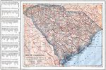
South Carolina,
1920 |
| Next | Last |
| Maps > United States > South Carolina |
Maps ETC is a part of the Educational Technology Clearinghouse
Produced by the Florida Center for Instructional Technology © 2009
College of Education, University of South Florida