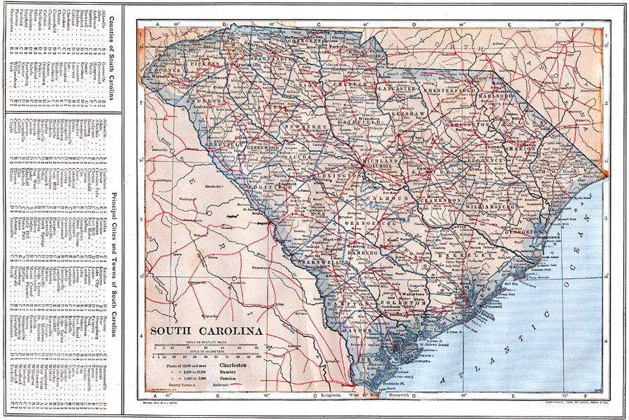
Description: A map from 1914 of South Carolina showing the capital Columbia, counties and county seats, principal cities and towns, railroads, rivers, and coastal features. A grid reference in the margin of the map lists counties, principal cities, and towns of South Carolina.
Place Names: South Carolina, Charleston, �Georgetown, �Spartanburg, �Columbia, �Sumter, �Marion, �Camden, �Aiken, �Anderson, �Pendleto
ISO Topic Categories: boundaries,
location,
inlandWaters,
oceans,
transportation
Keywords: South Carolina, physical, �political, �transportation, physical features, county borders, railroads, boundaries,
location,
inlandWaters,
oceans,
transportation, Unknown, 1914
Source: , The New Encyclopedic Atlas and Gazetteer of the World (New York, NY: P. F. Collier and Son, 1914) 48
Map Credit: Courtesy the private collection of Roy Winkelman |
|