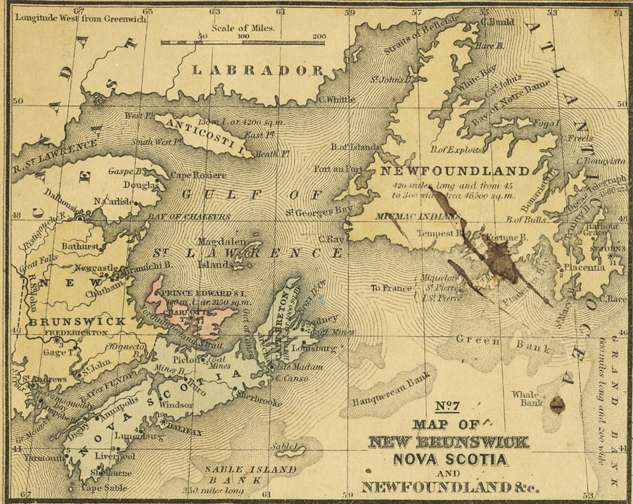
Description: A map from 1858 of New Brunswick, Nova Scotia and Newfoundland, which surround the Gulf of St. Lawrence. The map shows major cities and ports, rivers, and coastal features. The figures attached to Cities and Towns indicate the number of thousands of the population, thus Halifax 19 signifies 19,000 inhabitants. The figures attached to the islands indicate the number of miles of their length and area in square miles. Coal mining districts are shown, as well as the trans–Atlantic submarine telegraph cable terminus on Newfoundland.
Place Names: Canada, Canada, �New Brunswick, �Nova Scotia, �Newfoundland, �Prince Edward Island, �St John
ISO Topic Categories: boundaries,
inlandWaters,
location,
oceans
Keywords: New Brunswick, Nova Scotia and Newfoundland, physical, �political, physical features, major political subdivisions, boundaries,
inlandWaters,
location,
oceans, Unknown, 1858
Source: , Mitchell's School Atlas (Philadelphia, PA : E. H. Butler & Co., 1863)
Map Credit: Courtesy the private collection of Roy Winkelman |
|