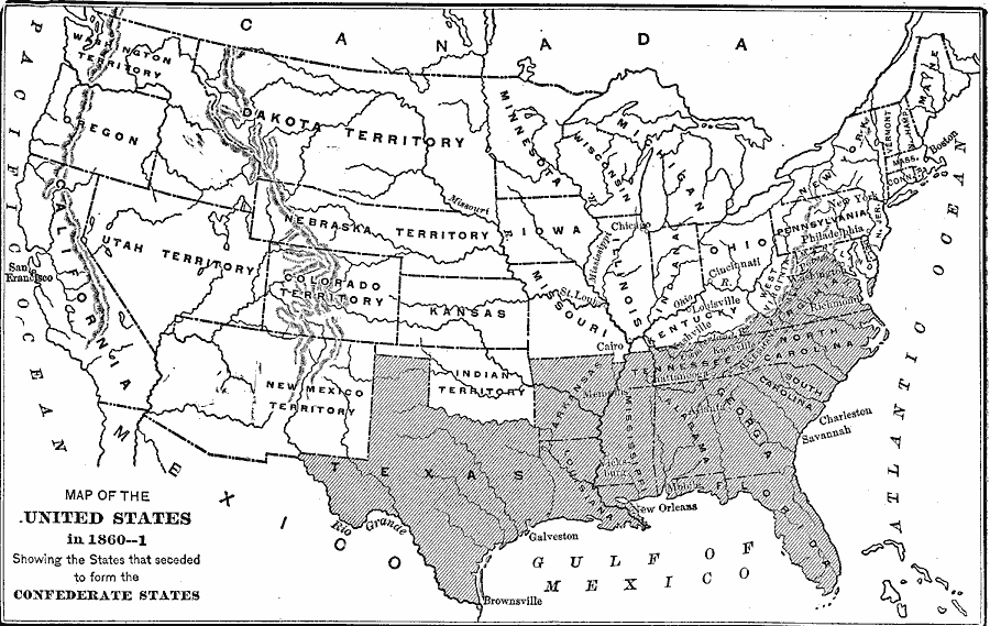
Description: A map of the United States at the outbreak of the Civil War (1860–1861) showing the States that seceded to form the Confederate States of America. The map also shows the territorial boundaries of the Washington Territory, Dakota Territory, Nebraska Territory, Utah Territory, Colorado Territory, Kansas Territory, New Mexico Territory, and the Indian Territory.
Place Names: Civil War, New York, �New Orleans, �Chicago, �Boston, �Washington D.C., �San Francisco, Galveston, Brownsville, Cairo, Philadelphia, Charleston, Savannah, Mobile, Memphis, St. Louis, Richmon
ISO Topic Categories: boundaries,
inlandWaters,
location,
oceans
Keywords: The United States at the Outbreak of the Civil War, physical, �political, �historical, �civil war, map of united states in 1860, 1861, confederate states, utah territory, washington territory, indian territory, dakota territory, physical features, country borders,
major political subdivisions, Civil War, boundaries,
inlandWaters,
location,
oceans, Unknown, 1860–1861
Source: Theodore Ayrault Dodge, A Bird's-Eye View of our Civil War (Boston, MA: Houghton, Mifflin and Company, 1897)
Map Credit: Courtesy the private collection of Roy Winkelman |
|
