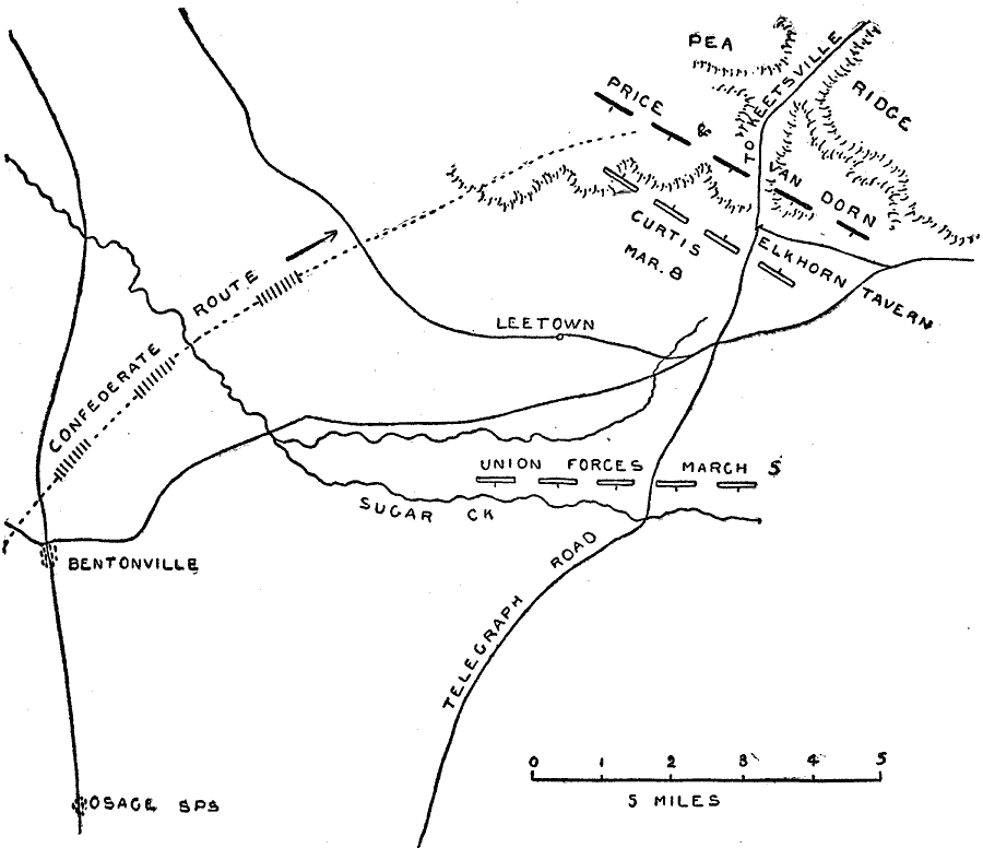
Description: A map of operations for the Battle of Pea Ridge, also known as the battle of Elk Horn, Arkansas. The battle took place March 5–8, 1862. The map shows Bentonville and Leetown, roads, terrain, and the Confederate and Union positions during the battle.
Place Names: Civil War, Benton, �Bentonville, �Osage Sps, �Telegraph Road, �Sugar Creek, �Leetown, �Pea Ridge, �Arkansa
ISO Topic Categories: location,
inlandWaters,
transportation
Keywords: Battle of Pea Ridge, physical, �historical, �transportation, �battle of pea ridge, battle of elk horn, civil war, elkhorn tavern, kBattle, physical features, roads, Civil War, location,
inlandWaters,
transportation, Unknown, March 1862
Source: Theodore Ayrault Dodge, A Bird's-Eye View of our Civil War (Boston, MA: Houghton, Mifflin and Company, 1897) 31
Map Credit: Courtesy the private collection of Roy Winkelman |
|