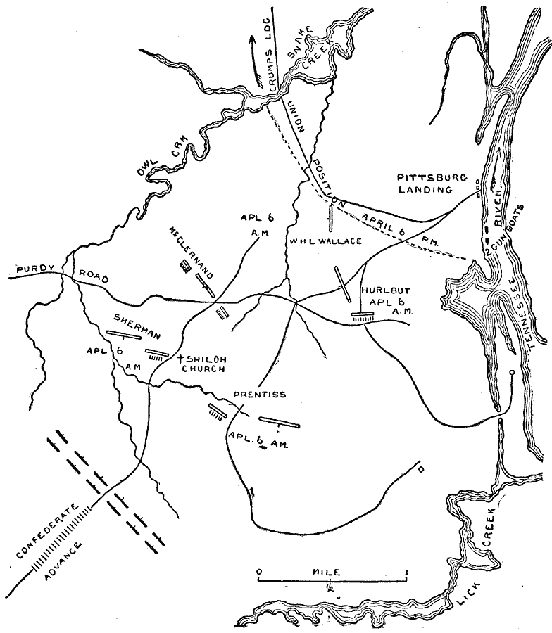
Description: A map of the area around Shiloh and Pittsburg Landing in Tennessee, showing the sites of the Battle of Shiloh, also known as the Battle of Pittsburg Landing. The battle took place on April 6–7, 1862. The map shows the Tennessee River, Owl Creek, the line of Confederate advance, and the Union positions and battle line at 6 in the morning and by 6 in the evening.
Place Names: Civil War, Shiloh Church, �Prentiss, �Pittsburg Landing, �Tennesse
ISO Topic Categories: location,
inlandWaters,
transportation
Keywords: The Battle of Shiloh, physical, �transportation, �historical, �Battle of Shiloh, �Battle of Pittsburg Landing, �Pittsburgh Landing, kBattle, physical features, roads, Civil War, location,
inlandWaters,
transportation, Unknown, April 1862
Source: Theodore Ayrault Dodge, A Bird's-Eye View of our Civil War (Boston, MA: Houghton, Mifflin and Company, 1897) 44
Map Credit: Courtesy the private collection of Roy Winkelman |
|