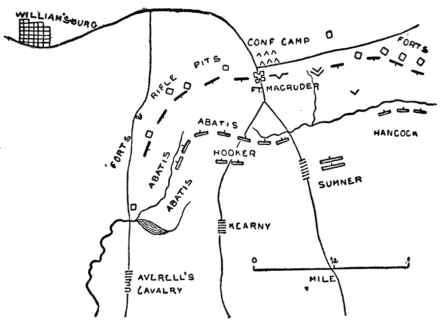
Description: A map of the area to the southeast of Williamsburg, Virginia, showing the Battle of Williamsburg or Battle of Fort Magruder, fought on May 5, 1862 during the Peninsula Campaign of the American Civil War. The map shows the Confederate camps and fortifications, and the Union line of advance.
Place Names: Civil War, Williamsburg, �Virgini
ISO Topic Categories: location,
inlandWaters
Keywords: The Battle of Williamsburg, physical, �historical, �battle of williamburg, may 5 1862, abatis, hooker, hancock, sumner, kearny, kBattle, physical features, Civil War, location,
inlandWaters, Unknown, May 5, 1862
Source: Theodore Ayrault Dodge, A Bird's-Eye View of our Civil War (Boston, MA: Houghton, Mifflin and Company, 1897) 53
Map Credit: Courtesy the private collection of Roy Winkelman |
|