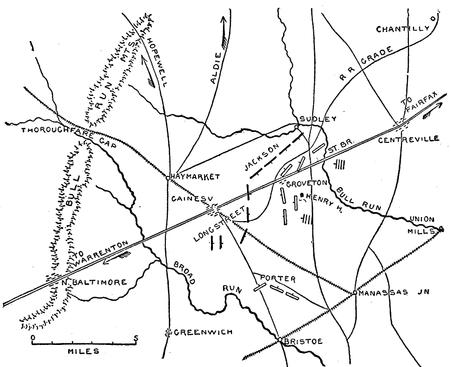
Description: A map of northern Virginia showing the area of the campaign of General Pope at noon on August 29, 1862 during the Second Battle of Bull Run. The map shows cities and towns, roads and railroads, terrain, woodlands, rivers, and the Union and Confederate positions along the Warrenton Turnpike between Bull Run Creek and Broad Run Creek.
Place Names: Civil War, Manassas Gap, �Culpeper, �Kelly's Ford, �Bealton, �Warrenton Junction, �Catletts, �Bristoe, �Manassas Junction, �Bull Run, �Haymarket, �Gainesville, �Warrenton, �Orleans, Waterloo, �Amissville, �Jefferson, �Salem, �White Plains, �Groveton, �Centrevill
ISO Topic Categories: location,
inlandWaters,
transportation
Keywords: Pope's Campaign, physical, �historical, �transportation, �pope's campaign, kBattle, physical features, roads,
railroads, Civil War, location,
inlandWaters,
transportation, Unknown, August 29, 1862
Source: Theodore Ayrault Dodge, A Bird's-Eye View of our Civil War (Boston, MA: Houghton, Mifflin and Company, 1897) 77
Map Credit: Courtesy the private collection of Roy Winkelman |
|