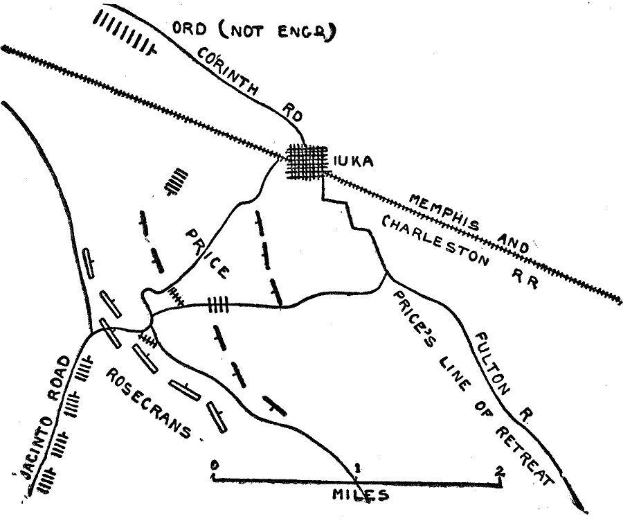
Description: A plan of the Battle of Iuka, Mississippi, on September 19, 1862, during the Iuka–Corinth Campaign of the American Civil War. The map shows the roads and railroad, the positions of Union General Rosecrans, and the positions and line of retreat of Confederate Price.
Place Names: Civil War, Iuka, �Fulton River, �Jacinto Road, �Mississipp
ISO Topic Categories: location,
inlandWaters,
transportation
Keywords: Battle of Iuka, physical, �transportation, �historical, �civil war battle of iuka mississippi, kBattle, physical features, roads,
railroads, Civil War, location,
inlandWaters,
transportation, Unknown, September 19, 1862
Source: Theodore Ayrault Dodge, A Bird's-Eye View of our Civil War (Boston, MA: Houghton, Mifflin and Company, 1897) 90
Map Credit: Courtesy the private collection of Roy Winkelman |
|