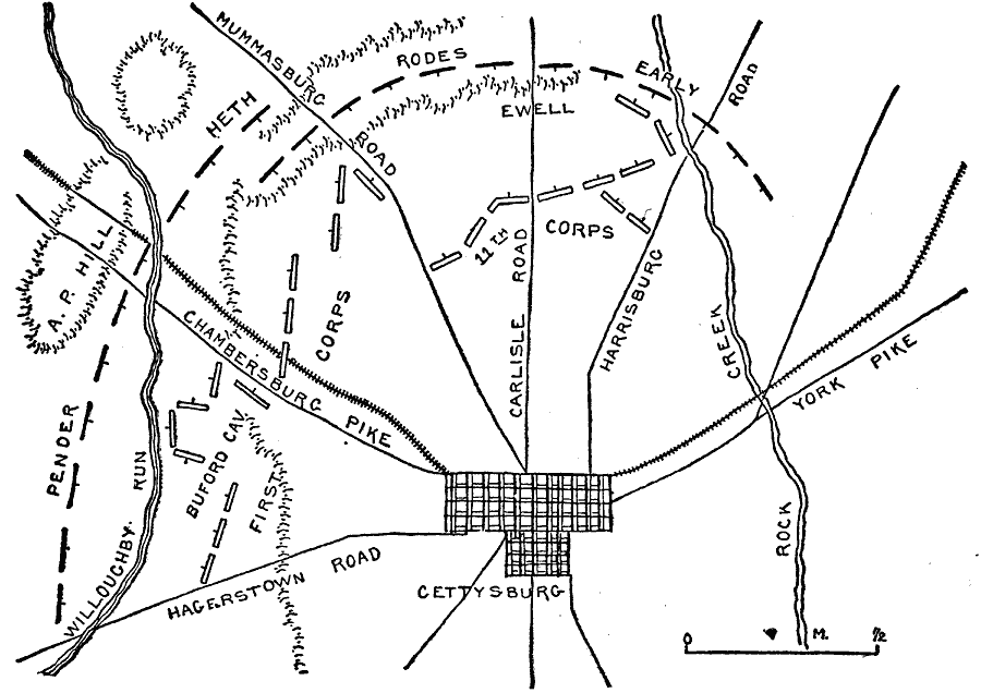
Description: A plan of the Battle of Gettysburg in the American Civil War. July 1 shown.
Place Names: Civil War, Gettysburg, Hagerstown Road, Willoughby Run, A. P. Hill, Chambersburg Pike, Mummasburg Road, Carlisle Road, Harrisburg Road, York Pike, Rock Cree
ISO Topic Categories: transportation,
location,
inlandWaters
Keywords: Gettysburg, physical, �political, �transportation, �historical, �pender, heth, rodes, early, buford cavalry, first corps, 11th corps, ewell, kBattle, physical features, roads,
railroads, Civil War, transportation,
location,
inlandWaters, Unknown, July 1, 1863
Source: Theodore Ayrault Dodge, A Bird's-Eye View of our Civil War (Boston, MA: Houghton, Mifflin and Company, 1897) 136
Map Credit: Courtesy the private collection of Roy Winkelman |
|