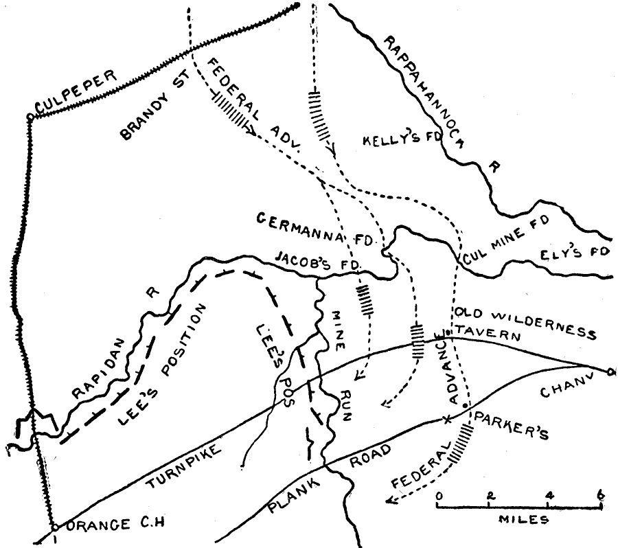
Description: The region near the Rappahannock river in Virginia, site of the Mine Run campaign. Map shows November 26–30, 1863.
Place Names: Civil War, Vicksburg, Milliken's Bend, Young's Point, Vicksburg And Shreveport Railroad, Yazoo River, Ohianes Bluff, Chickasaw Bay, Walnut Hills, Warrenton, New Carthage, Grand Gulf, Bayou Pierre, Port Gibson, Bruinsburg, Hawkinson's Folly, Cayuga, Utica, Edwards
ISO Topic Categories: transportation,
location,
inlandWaters
Keywords: Mine Run, physical, �political, �transportation, �historical, �american civil war, �mine run, kBattle, physical features, roads,
railroads, Civil War, transportation,
location,
inlandWaters, Unknown, November 1863
Source: Theodore Ayrault Dodge, A Bird's-Eye View of our Civil War (Boston, MA: Houghton, Mifflin and Company, 1897) 170
Map Credit: Courtesy the private collection of Roy Winkelman |
|
