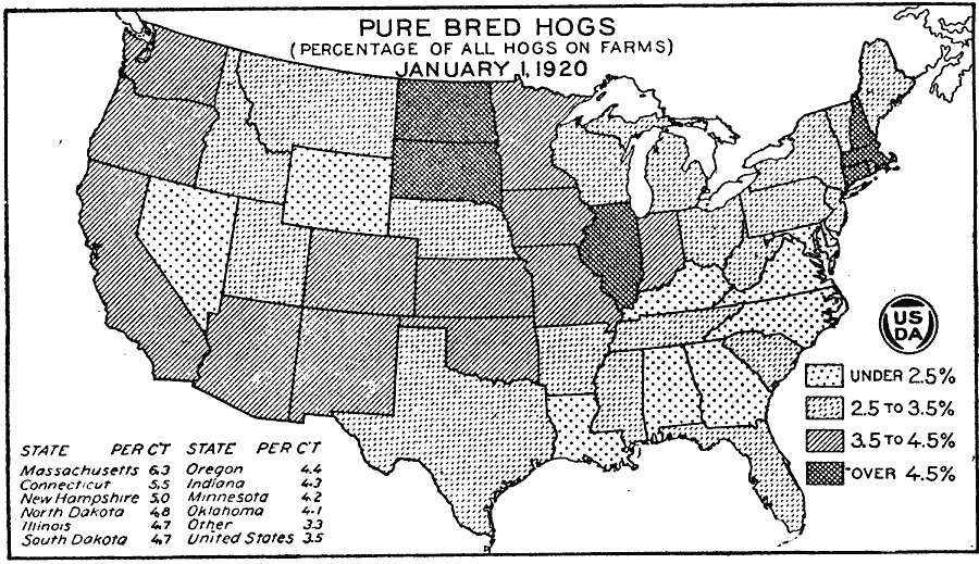
Description: A map of the United States from the U. S. Department of Agriculture (1922) showing the percentage of hogs on farms that were registered as pure bred as of January 1, 1920.
Place Names: Agriculture, Massachusetts, Connecticut, New Hampshire, North Dakota, Illinois, South Dakota, Oregon, Indiana, Minnesota, Oklahoma, �hog
ISO Topic Categories: boundaries,
inlandWaters,
oceans,
farming
Keywords: Pure Bred Hogs, physical, �political, �statistical, �pure bred hogs as a percentage of all hogs on farms on january 1 1920, kAgriculture, physical features, country borders,
major political subdivisions, agriculture, boundaries,
inlandWaters,
oceans,
farming, Unknown, 1920
Source: , United States Department of Agriculture Yearbook 1922 (Washington, DC: Government Printing Office, 1923) 194
Map Credit: Courtesy the private collection of Roy Winkelman |
|