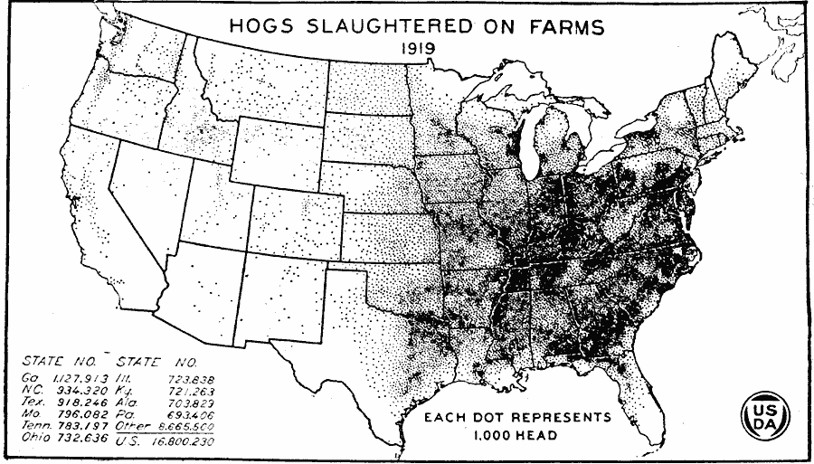
Description: A map of the United States from the U. S. Department of Agriculture (1922) showing the number of hogs slaughtered on farms in 1919.
Place Names: Agriculture, hog
ISO Topic Categories: boundaries,
inlandWaters,
oceans,
farming
Keywords: Hogs Slaughtered on Farms, physical, �political, �statistical, �hogs slaughtered on farms, kAgriculture, physical features, country borders,
major political subdivisions, agriculture, boundaries,
inlandWaters,
oceans,
farming, Unknown, 1919
Source: , United States Department of Agriculture Yearbook 1922 (Washington, DC: Government Printing Office, 1923) 200
Map Credit: Courtesy the private collection of Roy Winkelman |
|