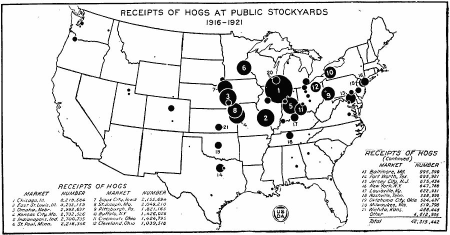
Description: A map of the United States from the U. S. Department of Agriculture (1922) showing the 21 largest swine markets ranked by annual receipts of hogs at public stockyards from 1916–1921.
Place Names: Agriculture, Chicago, �East St. Louis, Kansas City, Omaha, Indanapolis, St. Paul, Sioux City, St. Joseph, Pittsburgh, Buffalo, Cincinnati, Cleveland, Baltimore, Fort Worth, Jersey City, New York, Louisville, Nashville, Oklahoma City, Milwaukee, Wichita, �hog
ISO Topic Categories: farming,
boundaries,
economy,
inlandWaters,
location
Keywords: Receipts of Hogs at Public Stockyards, physical, �political, �statistical, �hog receipts public stockyards, swine market, kAgriculture, physical features, country borders,
major political subdivisions, agriculture,
economic, farming,
boundaries,
economy,
inlandWaters,
location, Unknown, 1916–1921
Source: , United States Department of Agriculture Yearbook 1922 (Washington, DC: Government Printing Office, 1923) 232
Map Credit: Courtesy the private collection of Roy Winkelman |
|