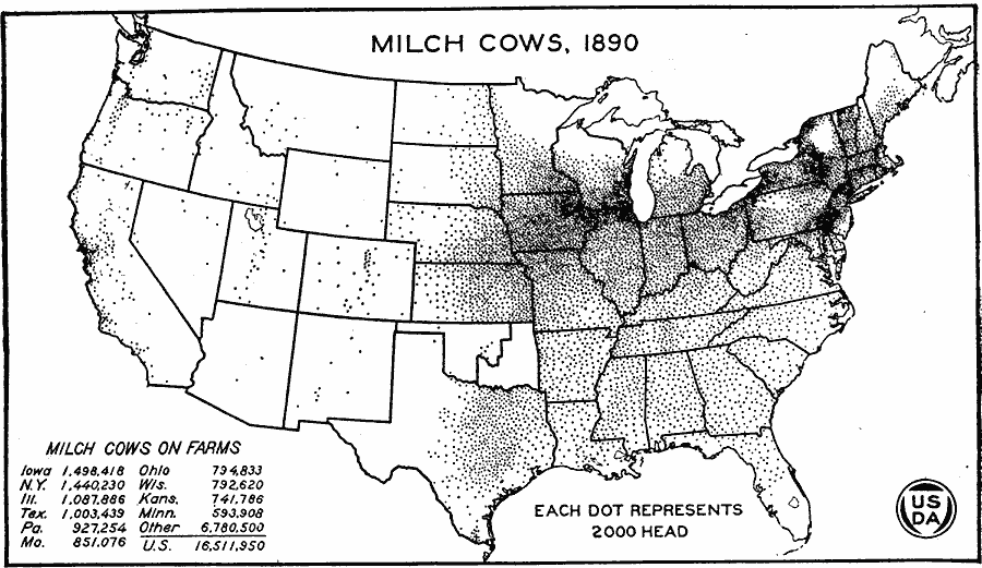
Description: A map of the United States from the U. S. Department of Agriculture (1922) showing the distribution of Milch Cows in the United States in 1890. "By 1890 Chicago had become the market center for the greatest dairy region of the United States. In number of cows Iowa ranked first, New York was a close second, and Illinois ranked third. Dairying had almost entirely displaced wheat growing in southern Wisconsin and northern Iowa and was beginning to take the place of wheat on farms in southern Minnesota." — United States Department of Agriculture Yearbook 1922, 1923.
Place Names: Agriculture, Iowa, New York, Illinois, Texas, Pennsylvania, Missouri, Ohio, Wisconsin, Kansas, Minnesota, �cattl
ISO Topic Categories: boundaries,
inlandWaters,
farming
Keywords: Milch Cow Distribution, physical, �political, �statistical, �milch cow distribution, milk cow, dairy cow, kAgriculture, physical features, country borders,
major political subdivisions, agriculture, boundaries,
inlandWaters,
farming, Unknown, 1890
Source: , United States Department of Agriculture Yearbook 1922 (Washington, DC: Government Printing Office, 1923) 300
Map Credit: Courtesy the private collection of Roy Winkelman |
|