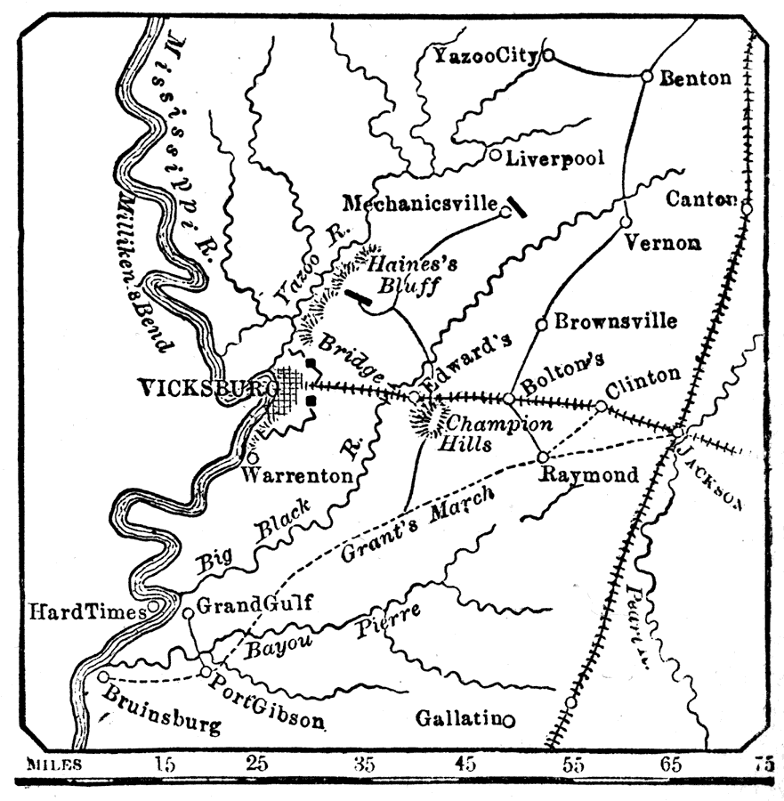
Description: A map of the vicinity of Vicksburg during the American Civil War. "Vicksburg, a city and port of Mississippi, on the Mississippi River, 408 m. N. of New Orleans, 441/2 W. of Jackson, built on a collection of high bluffs. It is the chief town between Memphis and New Orleans. In January, 1862, it was attacked by the U.S. naval forces from Memphis and New Orleans, but without success. In April, 1863, a naval attack was combined with the land forces under Gen. Grant, who defeated Gen. Pemberton near Jackson, cut off supplies and reinforcements from the garrison, and, by a close siege and continual assaults, compelled a surrender, July 4, 1863, with 30,000 prisoners of war, 200 cannon, and 70,000 stand of arms." — W. H. DePuy, 1881.
Place Names: Civil War, Vicksburg, �Haines Bluff, �Yazoo River, �Mississippi River,
ISO Topic Categories: inlandWaters,
society
Keywords: Vicksburg and Vicinity, physical, �transportation, �historical, physical features,
topographical, railroads, Civil War, inlandWaters,
society, Unknown, 1863
Source: W. H. DePuy, People's Cyclopedia of Universal Knowledge: V.2 (New York, NY: Phillips & Hunt, 1881) 1792
Map Credit: Courtesy the private collection of Roy Winkelman |
|