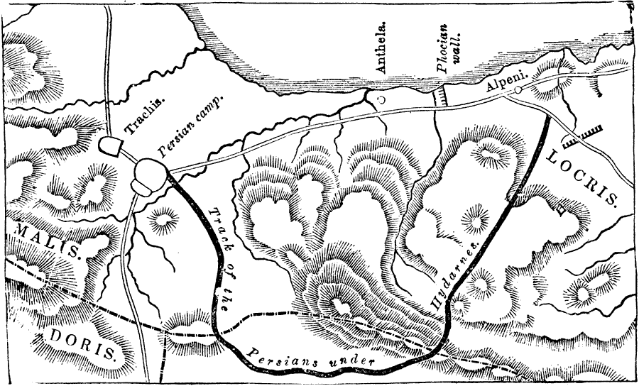
Description: A Map of Thermopylae. "The Greeks determined to make a stand at the pass of Thermopylae, which forms the entrance from northern into southern Greece. ...The Grecian fleet, under the command of the Spartan Eurybiades, took up its station off that portion of the northern coast of Eubea which faces Magnesia and the entrance to the Thessalian Gulf, and which was called Artemisium, from a neighbouring temple of Artemis (Diana). It was, however, only a small land–force that was sent to the defence of Thermopylae."— Smith
Place Names: Greece, Malis, �Doris, �Locris,
ISO Topic Categories: location,
inlandWaters,
intelligenceMilitary
Keywords: Thermopylae, physical, �historical, physical features, location,
inlandWaters,
intelligenceMilitary, Unknown,480 BC
Source: William Smith, A Smaller History of Greece (New York, NY: Harper and Brothers, 1882) 59
Map Credit: Courtesy the private collection of Roy Winkelman |
|