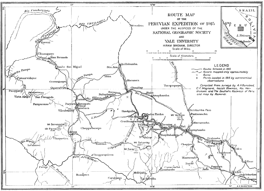
Description: A map of the Peruvian area explored on the joint Yale University–National Geographic Society expedition of 1915, led by Hiram Bingham, the discoverer of Machu Picchu in 1911. This map shows the routes of exploration from Cuzco into the areas of Machu Picchu, Tocopoqueyu, Quillabamba, Yuveni, Vilcabamba, Arma, and others, and shows archeological ruin sites, towns, major rivers, and prominent mountains. A locator map of Peru shows the area of map coverage and proximity to Lima and Lake Titicaca.
Place Names: Peru, Bolivia, �Brazil, �Colombia, �Cuzco, �Ecuador, �Machu Picchu, �Pacific Ocean, �Peru, �San Miguel, �South America, �Urubamb
ISO Topic Categories: oceans,
location,
inlandWaters
Keywords: Route Map of the Bingham Peruvian Expedition, discovery, �exploration, �historical, �physical, �prehistoric, � physical features, oceans,
location,
inlandWaters, Unknown, 1915
Source: Gilbert H. Grosvenor, ed., The National Geographic Magazine An Illustrated Monthly (Washington, DC: Judd & Detweiler Inc. , 1916) 434
Map Credit: Courtesy the private collection of Roy Winkelman |
|