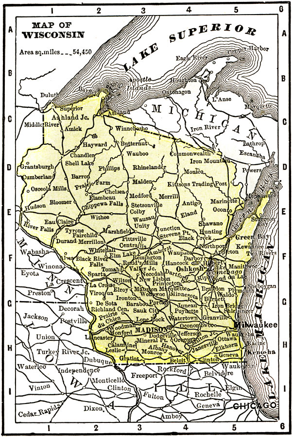
Description: A map from 1904 of Wisconsin showing the capital, Madison, principal cities and towns, railroads, rivers, and shoreline. "Wisconsin (The Badger State) — Was first settled by the French in 1660. Admitted to the Union in 1848. The manufacture of lumber and timber products is the most important industry in the State. Stands first in the United States in the value of its timber and lumber. The manufacture of flour and grist mill products ranks second. The State ranks fourth in the United States in the manufacture of malt liquors. Ranks thirteenth in population, twenty–fourth in square miles, seventh in iron ore, and fifth in wheat. Capital of the State is Madison. The Governor receives a salary of $5,000." — Wark, 1904.
Place Names: Wisconsin, Oshkosh, �Milwaukee, �Madison, �Wausau, �Lake Superior, �Lake Michiga
ISO Topic Categories: society,
inlandWaters,
transportation
Keywords: Wisconsin, physical, �political, �transportation, physical features, major political subdivisions, railroads, society,
inlandWaters,
transportation, Unknown, 1904
Source: Henry Wark, ed., Wark's Modern Educator (New York, NY: Henry Wark, 1904) 875
Map Credit: Courtesy the private collection of Roy Winkelman |
|