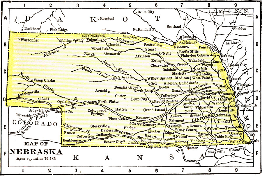
Description: A map from 1904 of Nebraska showing the capital of Lincoln, major cities and towns, railroads, and rivers. "Nebraska — Territory organized in 1854; admitted to statehood in 1867. Area, 15,378 square miles, and population 1,067,000. Primarily an agricultural and stock–raising State. It has slaughtering and meat packing industries, and Omaha is now one of the great cattle markets of the world. Lincoln has the largest creamery in the country. Omaha is the headquarters for the printing and publishing trade for the Middle West. The Governor receives a salary of $2,500." — Wark 1904.
Place Names: Nebraska, Lincoln, �Omaha, �Columbus, �Ft. Kearne
ISO Topic Categories: transportation,
society
Keywords: Nebraska, transportation, �physical, �political, physical features, major political subdivisions, railroads, transportation,
society, Unknown, 1904
Source: Henry Wark, ed. , Wark's Modern Educator (New York, NY: Henry Wark, 1904) 876
Map Credit: Courtesy the private collection of Roy Winkelman |
|