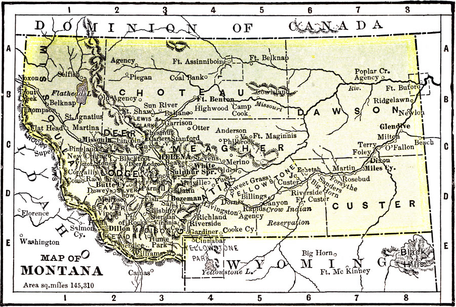
Description: A map from 1904 of Montana showing the capital of Helena, major cities and towns, railroads, rivers, and mountains. The boundaries of Yellowstone National Park, primarily in Wyoming, are shown. "Montana was organized as a Territory in 1864. Its settlement dates from the opening of the gold mines. Admitted as a State in 1889. Area, 146,080 square miles; population, 254,000. Ranks fourth in silver, fifth in gold, and first in copper. The smelting and refining of copper and lead are the chief industries. Cattle raising industry is of great importance." — Wark 1904.
Place Names: Montana, Butte, �Helena, �Dawson, �Custer, �Choteau, �Missoula, �Meagher, �Gallatin, �Yellowstone, �Dillon, �Bozema
ISO Topic Categories: society,
transportation
Keywords: Montana, physical, �political, �transportation, physical features,
topographical, major political subdivisions,
county borders, railroads, society,
transportation, Unknown, 1904
Source: Henry Wark, ed. , Wark's Modern Educator (New York, NY: Henry Wark, 1904) 879
Map Credit: Courtesy the private collection of Roy Winkelman |
|