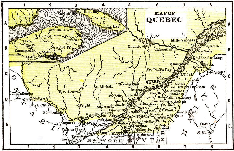
Description: A map from 1904 of the populous portion of Quebec Province, showing major cities and towns, railways, rivers, lakes, and the frontier with Ontario. An inset map shows the eastern portion of the province along the Gulf of St. Lawrence, including the Gaspé Peninsula and Anticosti Island. "Quebec was originally settled by the French, and the present population is largely composed of descendants of the Voyagers. The capital, Quebec, is the oldest city in the Dominion. Its fortifications were at one time considered, next to Gibraltar, the strongest in the world. Nevertheless, the fortress was captured by General Wolfe. The metropolis, Montreal, is noted for its churches." — Wark 1904.
Place Names: Canada, Montreal, �Quebec, �Ottawa, �St. Laurence River, �L'Islet, �St. Joseph, �St. Joh
ISO Topic Categories: inlandWaters,
society,
transportation
Keywords: Quebec, inlandWaters,
society,
transportation, Unknown, 1904
Source: Henry Wark, ed. , Wark's Modern Educator (New York, NY: Henry Wark, 1904) 882
Map Credit: Courtesy the private collection of Roy Winkelman |
|