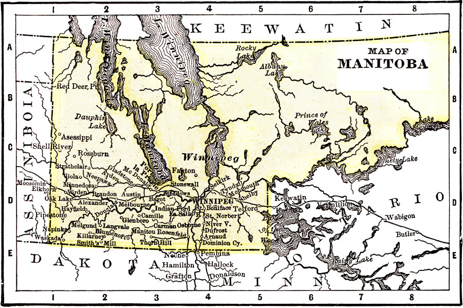
Description: A map from 1904 of Manitoba showing the provincial capital of Winnipeg and major cities and towns in the south, railways, terrain features, lakes, and rivers. The map shows the eastern border of the province extending into the present–day province of Ontario. "Manitoba is a wheat-growing country, and firs are also a leading product. The first settlers, 1731, were French, and English traders first made their appearance in 1767. The Province is now traversed by the Canada Pacific Railway. Climate very severe in winter, but occasionally hot in summer. The soil is such that wheat opens in 110 days. Winnipeg is the capital." &mdash Wark 1904
Place Names: Canada, Winnipeg, �Lake Manitoba, �Lake Winnepeg, �Prince of Wales Lak
ISO Topic Categories: inlandWaters,
society,
transportation
Keywords: Manitoba, physical, �political, �transportation, physical features, country borders,
major political subdivisions, railroads, inlandWaters,
society,
transportation, Unknown, 1904
Source: Henry Wark, ed. , Wark's Modern Educator (New York, NY: Henry Wark, 1904) 882
Map Credit: Courtesy the private collection of Roy Winkelman |
|