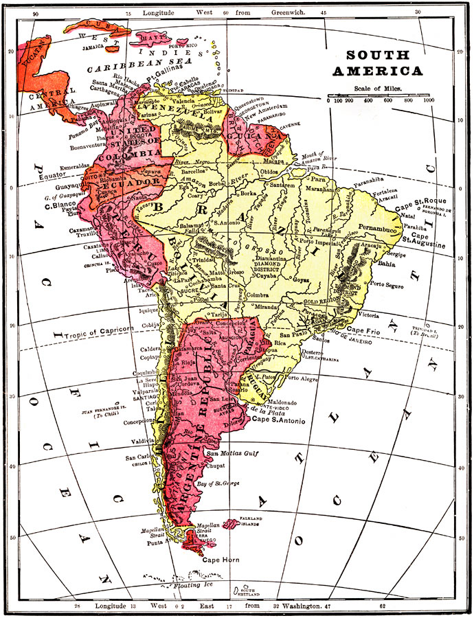
Description: A map of South America from 1904 showing the political boundaries of the time for the United States of Columbia, Venezuela, the British, Dutch, and French Guiana colonies, Brazil, Ecuador, Peru, Bolivia, Chile, Uruguay, and the Argentine Republic. This map shows Paraguay as part of the Argentine Republic at the time. The map shows capitals, major cities, ports, railroads, terrain, rivers, and coastal features. The map coverage includes the Yucatan Peninsula and the Caribbean islands of Cuba, Jamaica, Hayti, and Porto Rico. Longitudes from Greenwich are given at the top of the map, longitudes from Washington at the bottom.
Place Names: A Complete Map of South America, Argentina, �Brazil, �Chile, �Peru, �Venezuela, �Columbia, �Ecuador, �Uruguay, �Paraguay, �Bolivi
ISO Topic Categories: society
Keywords: South America, physical, �political, physical features,
topographical, country borders, society, Unknown, 1904
Source: Henry Wark, ed. , Wark's Modern Educator (New York, NY: Henry Wark, 1904) 902
Map Credit: Courtesy the private collection of Roy Winkelman |
|