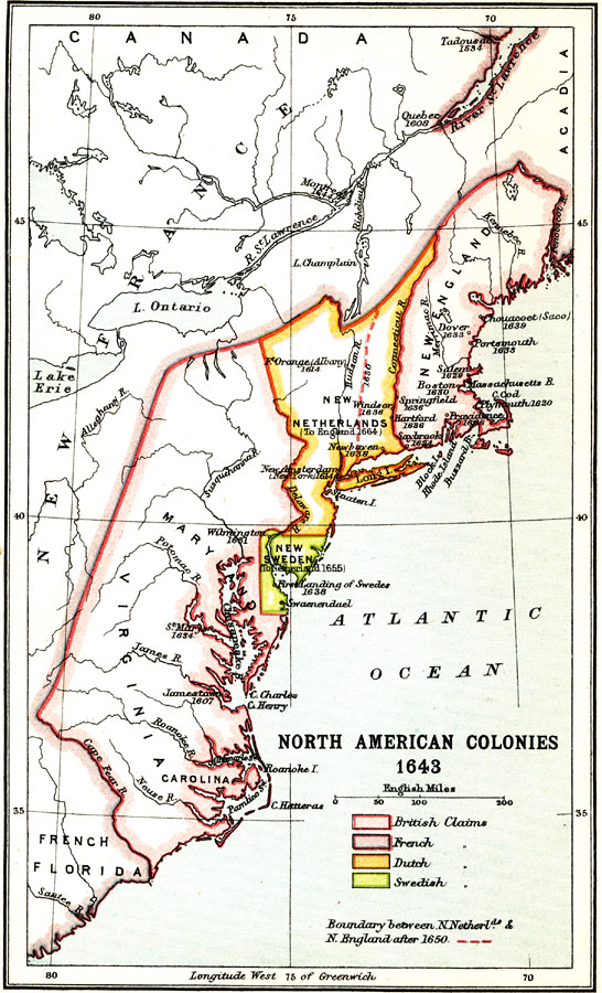
Description: A map of the North American Colonies in 1643 at the establishment of the New England Confederation. The map is color–coded to show the territorial claims of the British, French, Dutch, and Swedish at the time, and shows the British colonies of New England, Maryland, Virginia, and Carolina, the Dutch colony of New Netherlands, the Swedish colony of New Sweden, and the frontiers of French Florida, New France, and Acadia. The map shows settlements with dates of founding given, and indicates New Sweden ceded to New Netherlands (1655), the boundary of New Netherlands after the Treaty of Hartford (1650), ceding the territory west of the Connecticut River to New England, and New Netherlands ceding to England in 1664.
Place Names: Early America 1400-1800, United States, �Canada, �Maryland, �New Enland, �New Sweden, �New Netherlands, �New Franc
ISO Topic Categories: society,
boundaries
Keywords: North American Colonies, historical, �physical, �political, physical features, society,
boundaries, Unknown, 1643
Source: Ernest Rhys, Ed., A Literary and Historical Atlas of North & South America (New York, NY: E.P. Dutton & CO., 1911) 6
Map Credit: Courtesy the private collection of Roy Winkelman |
|