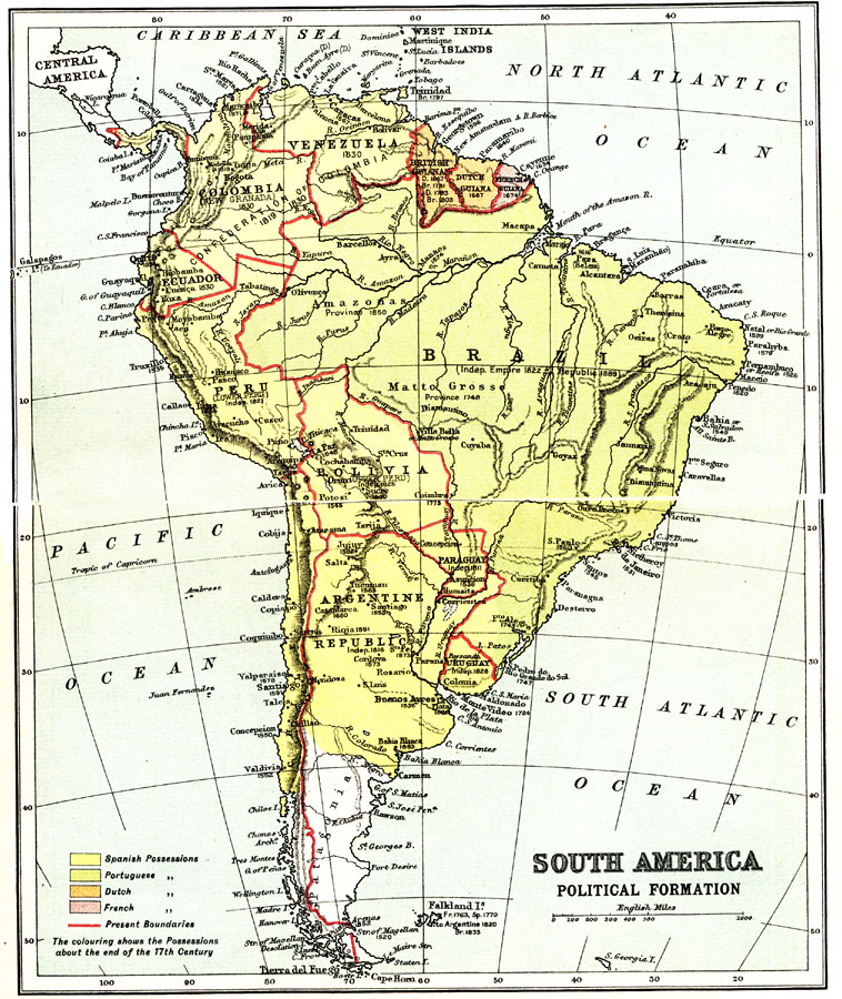
Description: A map from 1911 of South America showing the political boundaries of the time, major cities, terrain, rivers, and coastal features. The map is color–coded to show the Spanish, Portuguese, Dutch, and French possessions about the end of the 17th century, the pre–independence boundaries, older territorial names, and dates of independence from foreign rule.
Place Names: A Complete Map of South America, Argentina, �Brazil, �Chile, �Columbia, �Venezuela, �Uruguay, �Per
ISO Topic Categories: society,
boundaries
Keywords: South America Political Formation, physical, �political, �historical, physical features,
topographical, country borders, society,
boundaries, Unknown, 1911
Source: Ernest Rhys, Ed., A Literary and Historical Atlas of North & South America (New York, NY: E.P. Dutton & CO., 1911) 22
Map Credit: Courtesy the private collection of Roy Winkelman |
|