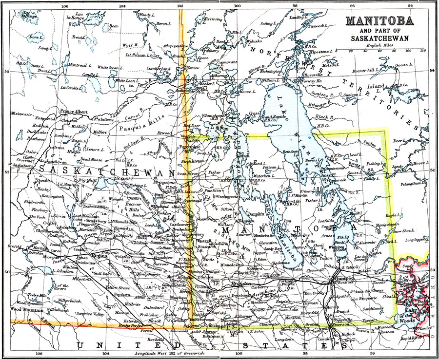
Description: A map from 1911 of Manitoba and the eastern part of Saskatchewan showing the provincial capitals of Winnipeg and Regina, major cities and towns, primary, secondary, and proposed railways, Indian reservation lands, lakes, and rivers. This map shows the boundaries of Manitoba before the territorial expansion in 1912 north to the Hudson Bay. At this time, Manitoba was referred to as the "Postage–stamp Province."
Place Names: Canada, Winnipe
ISO Topic Categories: transportation,
society
Keywords: Manitoba, transportation, �political, major political subdivisions,
country borders, railroads, transportation,
society, Unknown, 1911
Source: Ernest Rhys, Ed., A Literary and Historical Atlas of North & South America (New York, NY: E.P. Dutton & CO., 1911) 50
Map Credit: Courtesy the private collection of Roy Winkelman |
|