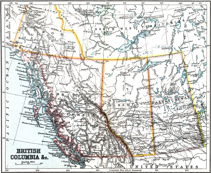
Description: A map from 1911 of British Columbia, Alberta, Saskatchewan, and the southern portions of Yukon and the Northwest Territories. The map shows the provincial capitals of Victoria, Edmonton, and Regina, and territorial capital of White Horse (Whitehorse after 1957), and other major cities and towns. The territorial capital of Yellowknife in the Northwest Territories was not established as the capital until1967. The map shows the railway network with connections to the United States, mountain systems, lakes, rivers, coastal features and islands.
Place Names: Canada, Alberta, �Saskatchewan, �Yuko
ISO Topic Categories: society,
transportation
Keywords: British Columbia, Alberta, and Saskatchewan, transportation, �political, �physical, physical features, country borders,
major political subdivisions, railroads, society,
transportation, Unknown, 1911
Source: Ernest Rhys, Ed., A Literary and Historical Atlas of North & South America (New York, NY: E.P. Dutton & CO., 1911) 52
Map Credit: Courtesy the private collection of Roy Winkelman |
|