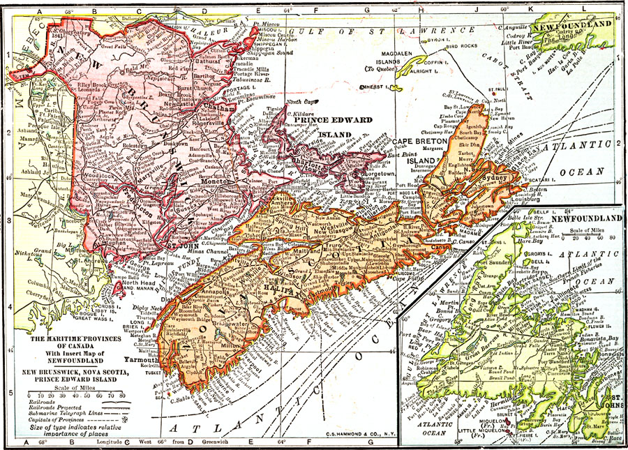
Description: A map from 1912 of the Maritime Provinces of Canada, including New Brunswick, Nova Scotia, and Prince Edward Island. The map shows the provincial capitals of Fredericton (New Brunswick), Halifax (Nova Scotia), and Charlottetown (Prince Edward Island), major cities, towns, and ports, existing and proposed railways, submarine telegraph routes, coastal features and smaller islands. An inset map details Newfoundland, and includes the French possessions of Miquelon, Little Miquelon, and St. Pierre Island.
Place Names: Canada, New Brunswick, �Prince Edward Island, �Nova Scotia, �Newfoundland, �Atlantic Ocean, �Gulf of Lawrence,�Halifa
ISO Topic Categories: boundaries,
inlandWaters,
oceans,
transportation,
utilitiesCommunication
Keywords: The Maritime Provinces of Canada With Insert Map of Newfoundland, physical, �political, �transportation, �telegraph lines, physical features, country borders,
major political subdivisions, railroads, boundaries,
inlandWaters,
oceans,
transportation,
utilitiesCommunication, Unknown, 1912
Source: The Manitoba Free Press, The Free Press Almanac Encyclopedia and Atlas (New York, NY: C. S. Hammond & Co., 1912) XVIII
Map Credit: Courtesy the private collection of Roy Winkelman |
|