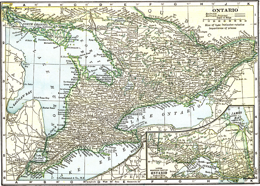
Description: A map from 1912 of the province of Ontario with an inset map of the western part of the province. The map shows the Canadian capital of Ottawa, the province capital of Toronto, major cities and towns, railways, lakes and rivers of the province.
Place Names: Canada, Ottawa, �Toronto, �Ontario, �Lake Ontario, �Lake Erie, �Lake Huron, �Georgian Bay, �James Bay, �Lake Superio
ISO Topic Categories: boundaries,
inlandWaters,
transportation
Keywords: Ontario, physical, �political, �transportation, physical features, country borders,
major political subdivisions, railroads, boundaries,
inlandWaters,
transportation, Unknown, 1912
Source: The Manitoba Free Press, The Free Press Almanac Encyclopedia and Atlas (New York, NY: C. S. Hammond & Co., 1912) XX
Map Credit: Courtesy the private collection of Roy Winkelman |
|