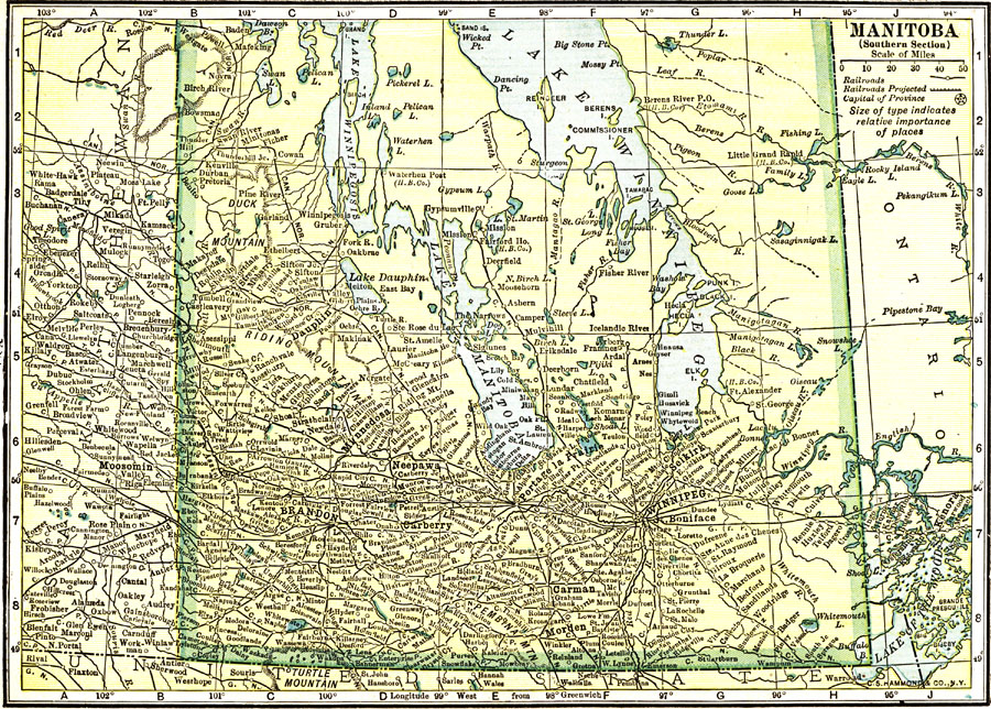
Description: A map from 1912 of the southern part of the province of Manitoba. The map shows the provincial capital of Winnipeg, major cities and towns, existing and proposed railways, lakes, and rivers of this portion of the province.
Place Names: Canada, Winnipeg, �Manitoba, �Lake Winnipeg, �Lake Manitoba, �Brandon,
ISO Topic Categories: boundaries,
transportation,
inlandWaters
Keywords: Manitoba (Southern Section), physical, �political, �transportation, physical features,
topographical, country borders,
major political subdivisions, railroads, boundaries,
transportation,
inlandWaters, Unknown, 1912
Source: The Manitoba Free Press, The Free Press Almanac Encyclopedia and Atlas (New York, NY: C. S. Hammond & Co., 1912) XXI
Map Credit: Courtesy the private collection of Roy Winkelman |
|